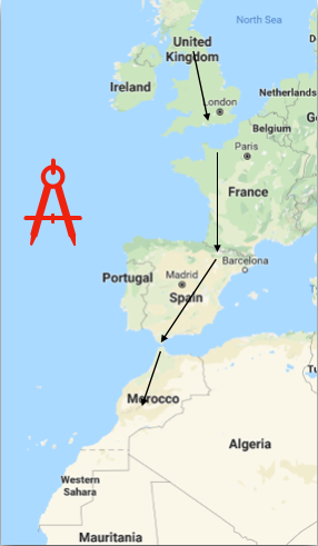
In 2015 I cycled from the UK to the south of France and, riding along quiet and scenic French country roads, I began to contemplate my next journey.
I considered another cycle ride. I had been inspired by Andrew P Sykes and his book, 'Crossing Europe on a bike called Reggie' so I thought about cycling to Morocco; which transformed into running to Morocco; which, and I'm not sure how, evolved into running an ultra-marathon each day from the highest point in Yorkshire, Whernside (736m), to the highest point in Morocco, Jbel Toubkal (4167m), unsupported ... Y2M was born.

In 2016 the planning began, and the training, for a June 2017 departure. An ultra-distance is generally regarded as anything more than the conventional marathon distance of 26 miles 385 yards or 42.2km. I planned to run 30 miles each day, or 48km. I worked out that at that daily mileage I would need 66 days, which was time I didn't have. I reckoned that I could do it in less.
I broke the route down into four stages: England, France, Spain and Morocco. I laid four maps out on the kitchen floor and divided the route into 53 manageable days, but without a rest day!

Support from Sportsshoes.com
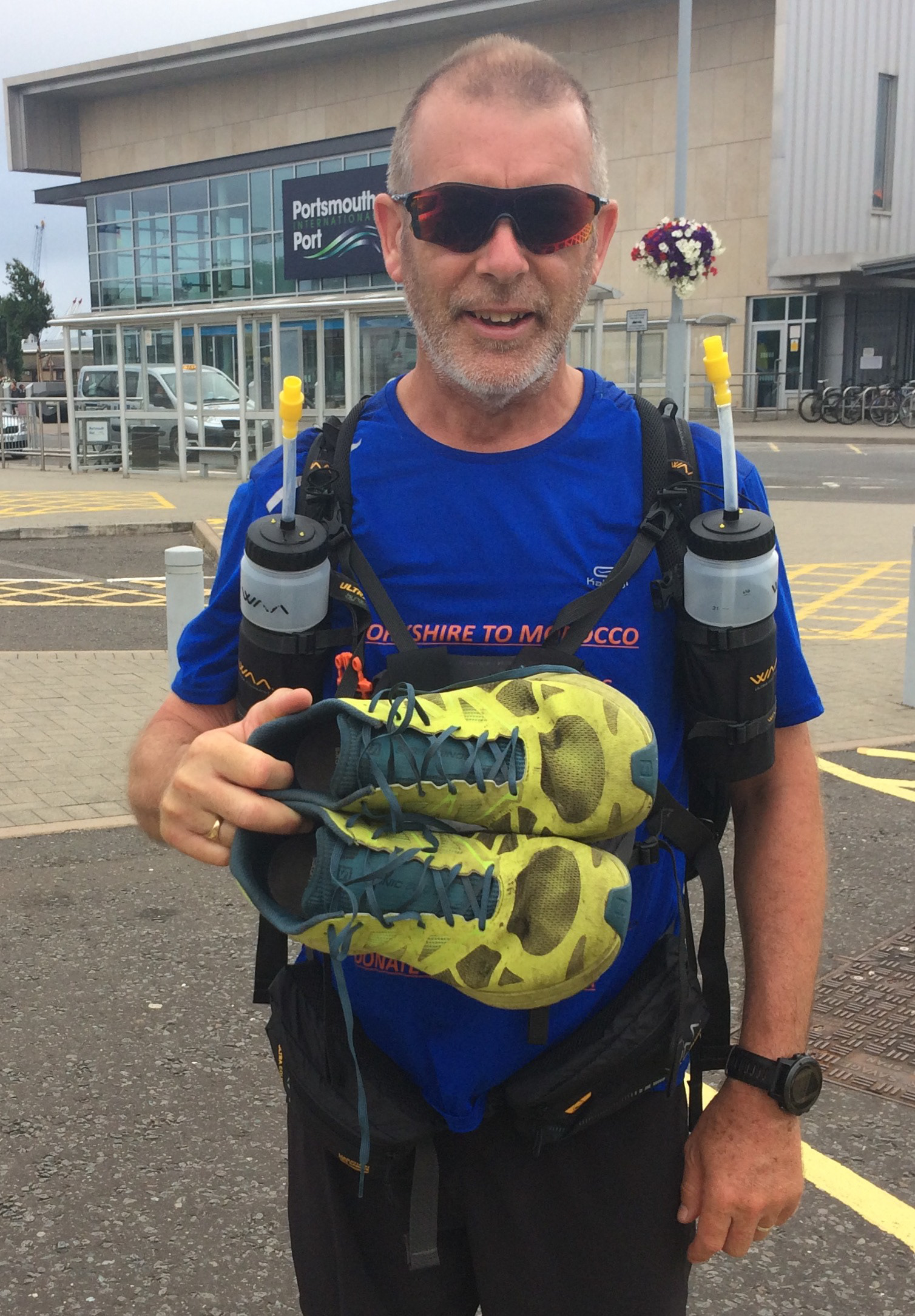
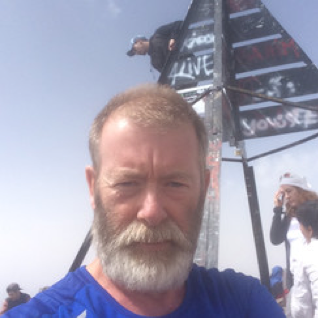
The Start: Whernside
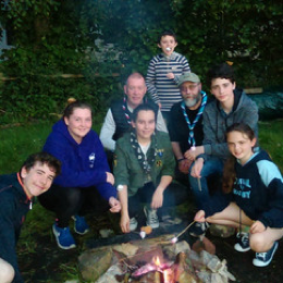
Explorer Scouts

Greenham Common
ENGLAND
You may have gathered I'm a Scout, an adult volunteer, and at the time of Y2M I was the Regional Commissioner for the NE of England. Through Scout friends and colleagues across England I arranged overnight accommodation from my start in Yorkshire to Portsmouth. Members of the Scout family provided me with an overnight stop over the eight days it would take to reach the south coast. En-route I would have the opportunity to spend time with other Scouts such as the Explorer Scouts in Burnley & Pendle District who provided accommodation at their Scout HQ and with Castle Bromwich Scout Group .
17 June was Day 1. Friends and family joined me on the summit of Whernside and at 10am I began my 2000-mile journey. Friends from my local running club escorted me to Settle from where I set out on my lonesome to Fence, Burnley.
I estimated I would get about 500 miles from a pair of running shoes. I used Salomon SonicPro2 which were kindly provided by Sportsshoes.com and over the whole distance I suffered from no significant problems with my feet.
PREPAREDNESS
Q: How do you prepare to run 2000 miles? A: Slowly and over a long period of time!
I set myself a timeline from spring 2016 to June 2017. I had to gradually increase the distance run in training, the amount of weight carried in my 'ultra-bag' [backpack] and teach my body to eat 'on the go'. I could not carry things like energy gels and recovery powders as I simply did not have sufficient space for 53 days’ worth of stuff. I would re-supply en-route.
There is a general rule in running about increasing mileage, the 10% rule; one should only increase mileage in increments of 10% to avoid injury and remain 'safe'. I planned to reach my highest level of training towards the end of March 2017 to allow time to consolidate and to reduce the risk of injury in the weeks before D [departure] Day. It was important that my body became used to continuous days of physical stress.
I should point out that I am not an expert but I did read a great deal into some of the strategies I employed to train and stay healthy. My diet varied to manage the changing levels of workload so proteins, carbohydrates and fats were adjusted accordingly, my overall intake of fluids increased (I generally don't drink enough water) and I endeavoured not to use energy gels too much in training, although I did use recovery powders to help after long training days, as I wouldn't have these when running.
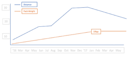
1 litre of water weights 1 kilogram. I would be running across Europe at the hottest time of the year and I knew some of the days in central Spain were across sparsely populated areas. I envisaged carrying 3 litres of water on some of those days and needed to be able to cope with carrying that weight.
I would run to work and back, a twenty-eight-mile round trip, or cycle. I set myself a routine of core strengthening exercises and sought the help of Helene at Horsforth Health Hub for regular physio, who kept me on-track and ensured I remained injury free with early interventions when I began to have those tell-tale aches.
My 'regular' long run would be from home along the Leeds & Liverpool Canal towards Keighley and around the fifteen-mile mark I would turn and head home, a 30-mile run. The Five Rise Locks at Bingley became a regular feature and it was a pleasant run. It did help to build the physical strength I would need but also the mental resilience to manage the hours I would be spending running on my own.
I gradually built up the frequency of running, cycling or core to six days per week with a Monday rest day, I generally ran the big stuff on a weekend. I would eat whilst running to train myself to be able to run and stomach different foods, although I did have to slow down on occasions when some items became a little 'claggy'.
I managed to reach June injury free, physically and mentally prepared, and confident that I would complete the challenge but I hadn't factored in an English summer heatwave!
ENGLAND
Whernside summit was cloaked in cloud and it was cool on the top. Descending to Ribblehead it cleared and the sun shone. It was 37 miles from Whernside to Fence, Burnley and an evening with the Explorer Scouts. Day 2 was from Fence to Disley, Manchester - 39 miles. When I arrived there in the late afternoon it was still 32C! It was something of a baptism of fire. I had developed a 'hot spot' on my right foot and had to treat this when I arrived at Andrew's in Manchester. It panicked me somewhat to have this at such an early stage but it resolved itself with no further problems. Anyway, onwards; Uttoxeter - Coleshill 32m - Chipping Norton 43m - Wantage 30m - Itchen Abbas 40m - Portsmouth 30m.
I remain very grateful to everyone who helped me reach Portsmouth.
One disadvantage to planning the most direct route is that I didn't always account for the terrain. I ran out of Buxton on the A53 and began the climb towards Flash. Flash Bar Cafe is the highest village store, and cafe, in England at 462m (1515ft). Trust me to choose this route. It was not so much that I wanted to stop at the cafe, I had to stop and take on some calories, the long climb to Flash Bar had expended a lot of energy. Several cups of tea and some very calorific cake got me back on track. There was a toll bar here from 1771 and the tollhouse is still there.
The one thing of note about England's roads is that many do not cater for pedestrians. I was forced to run through roadside undergrowth on many occasions. I spent an uncomfortable night in Chipping Norton suffering from quite a severe rash to my lower legs and had to call at a pharmacy for hydrocortisone cream before starting the next day. It became a very frustrating period of running.
I ran across Greenham Common a Site of Special Scientific Interest (SSSI) and very different now from its time as an RAF station and USAF base. It is difficult to tell the base existed at all apart from the hangars that remain where cruise missiles were stored on TELs (transporter erector launchers) which were mobile and would travel from the base to secret locations should the need arise. The hangars were used in the filming of Star Wars: The Last Jedi.
It was probably the protests against the siting of nuclear weapons that lasted for nineteen years for which the area is most noted. It felt quite surreal running over this stretch of common land now covered with gorse, heather and full of wildlife remembering the news items on TV during the 1980's showing women linking arms around the six-mile perimeter fence of the base.
Running past Brize Norton I had a close encounter with a very large RAF transport plane. The public road passes across the end of the runway and is controlled at either end by traffic lights to stop cars when an aircraft is landing. I passed the green traffic light, which unbeknown to me changed immediately to red. My slow pace changed into a sprint as the huge aircraft came into land, which was not easy with legs that were already very tired and refused to respond.
I had posted some new running shoes ahead to Scout friends in Portsmouth and so well fed, showered and with new shoes I boarded the Portsmouth-Caen ferry for the overnight crossing, kindly provided by Brittany Ferries.
FRANCE
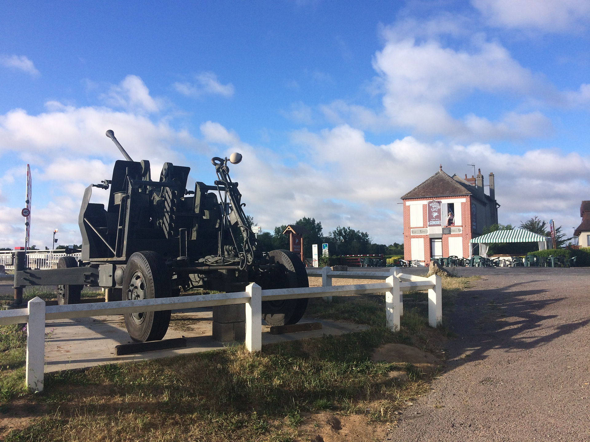
The straight-line route from Yorkshire to a south coast ferry port was to Portsmouth. It meant that I would arrive in Caen (Ouistreham) and be able to see the site of Pegasus Bridge at Benouville where Allied soldiers, as a glider born force, landed to secure the bridge on 6 June 1944. Cafe Gondree claims to be the first house liberated on D Day and is still owned by the Gondree family. It had not opened for service as I ran past along the Caen Canal.
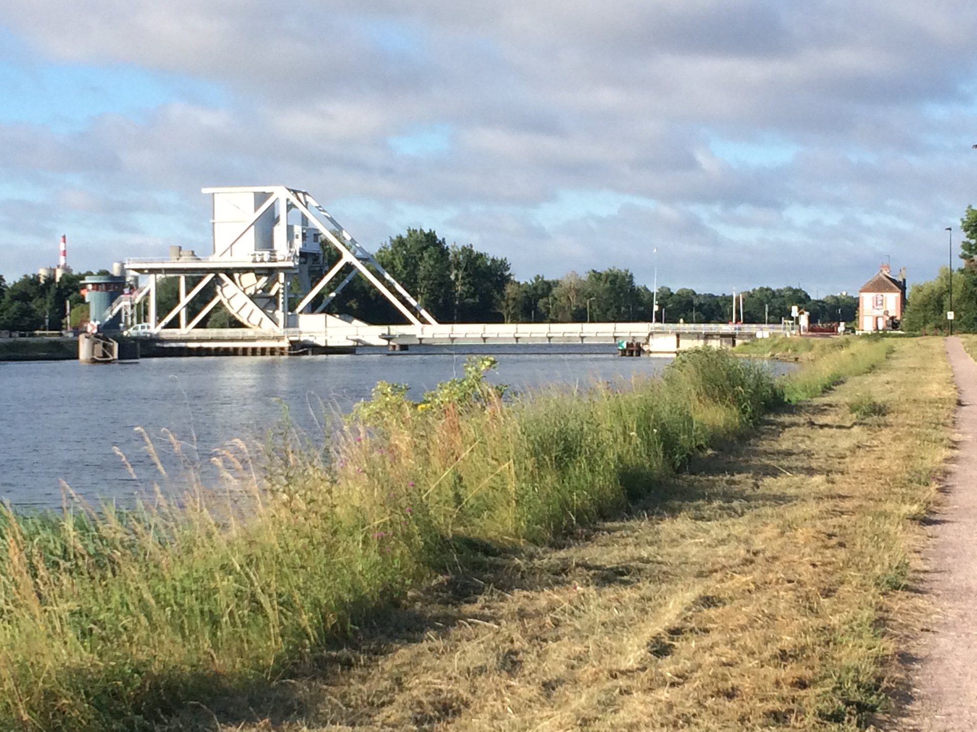
Caen Canal - Benouville

Route Book
Cafe Gondree
I had devised a route book for the whole journey. I endeavoured to remain on roads which would give better access to supplies and make getting lost on a remote track less likely. The route from Caen was a 45-mile day, so getting lost and having to increase mileage was just not an option.
The route book was a small reporter type so I could remove pages as I completed days. It got lighter the further I travelled. Not by much but every little counted!
Northern France was quite cool, much more so than England and the first days of running were fairly comfortable.
I made a note in my log that; on arriving at Flers I had gone to get food when I was nearly run over by a car as my legs would not carry me quickly enough across the road I was so tired!
I had planned to either camp or find a room en-route. My wife began to run a mini command room from the south of France and found accommodation for me as I progressed on my route, providing information about mileage to potential villages/towns for re-supply. This meant that at the end of each day's run I could shower and have a good night’s sleep, and tend to the sore parts of my body.
I had found people to be so helpful when I cycled across France and this was again the case. I planned to stop on Day 11 at the town of Chateau Gontier but Lynn couldn't find anywhere in the town for me so I had a room at a chambre d'hôte just outside the town. I ran along the riverside of the Mayenne, which in the late afternoon was beautiful, to the house La Francoisiere
The owner of the house, Philippe, was enthused by my run, and very supportive. I had a meal with Philippe, his wife and daughter and they put all of my kit through the washing machine ready for the next day (I had gotten used to the smell!). Philippe would not allow me to pay for my accommodation in support of my efforts. It was acts of kindness such as this that inspired me.
The beard was coming on nicely (I didn't have space for shaving kit)
Day 15 was to Venerand - 38 miles. As I ran along the D150 I saw my saviours come into view. Jane and Keith have a mobile home near Royan and they had offered overnight accommodation, providing the superb hospitality that they are renowned for. It was good to have a conversation with someone after fifteen days on the road. My right knee had started to become painful around day ten and was worsening. I spent time with it iced to try and reduce the swelling. It provided a real moral boost to spend an evening with them and Jane & Keith kindly took me to Pons the next morning to start the next leg.
I knew I had to do something about the knee problem but I was determined to keep to the schedule I had set. It was a balance. I kept a sedate pace. Day 17 ended at Bordeaux and Google Maps directed me to a Decathlon store, I needed new running shoes and a knee support. I managed to get to the store before closing at 8pm and got the equipment I needed and selfies with the store staff!
My knee problem persisted to Soria in Spain but with some tlc each evening I nursed the injury through, thank goodness.
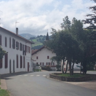
I ran through the town of Saint Jean Pied-de-Port en-route to the Pyrenees. The town is on the route of the Camino de Santiago (Way of St James) and I think many thought I was on a pilgrimage to Santiago de Compostela as I was greeted with 'bonne route' by everyone as I passed through.
Pons
Urepel - Pyrenees

I was in Spain!
Pamplona
Just beyond St. Jean I was running towards the Pyrenees when I heard a voice near to me. I assumed it was the radio of a car that had just gone passed and thought nothing more of it. I was tired and had an uphill run to the village I was staying at. The voice continued. I looked over my shoulder and there was an English chap running alongside me, I hadn't realised he was there. He had left his family in St. Jean whilst he ran back to collect his car from the next village, they had been out walking. We ran together for a while until he turned off to get his car. You can meet people in the strangest of circumstances!
SPAIN
I was somewhat daunted by the thought of having to cross the Pyrenees but being to the west of the range, towards the coast, meant that I avoided the big peaks which were further east. Nonetheless it was a challenge to both my body and my mind. Thankfully, a narrow tarmacadam road wound its way over and through the mountains. It was demanding but, with the early morning earth scents and raptors flying overhead, calling out their presence, there were some pleasurable moments that distracted me from the pain. I crossed the watershed, passed through a fence into what looked like a national park and - I was in Spain!
It was then a steady run, mostly downhill, to the main road, the N-135, where I turned right to Pamplona. The symbol (Scallop Shell) depicting the Camino de Santiago was ever-present and there were roadside stalls selling fruit for the pilgrims. The origins of the route go back to the 9th century so it is a well-worn path! I bought some bananas to help give me some energy to reach Pamplona.
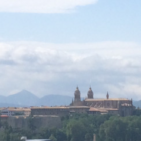
Pamplona was packed with people, it was the encierro, the running of the bulls. It is a huge festival and after running over the mountains it was a real shock to the senses to see so many people, all in party mode wearing white with the traditional red scarf. It was a struggle to get through the crowds to find my room for the night and it felt like I was the only sober person in the city. The following morning I had to work my way around people strewn on the city's streets, sleeping on grass verges or just passed-out in the road. I didn't hang around for the bulls!
I had consolidated my routine by now. I still had knee problems, and was still wearing the support so my first task at the end of each day was to find ice. I would get cleaned up, lay down for an hour with the ice pack on my raised knee then tend my other sore bits. Whilst my feet were not blistered I looked after the tender parts and applied cream where needed. I cleaned my kit, using the accommodation's free shower gel, and hung to dry. I generally found food en-route to my accommodation and stocked up for the following day.
KIT & ROUTINE
I carried: 2x 750ml water bottles; MSR Micro Stove; MSR Titanium Kettle; Outdoor Research Bivouac; Sleeping Bag & Therm-a-Rest NeoAir; Medical Kit incl. sun protection cream and toothbrush/toothpaste; Spare shirt & Shorts; RAB Down Gilet; Waterproof Jacket; 3 Pairs Socks; Skins Compression Tights & Calf Sleeves; Lightweight Shoes (post-run); Cap; Sunglasses; Victorinox Knife; Mobile 'Phone; Road Book; Petzl Head-torch; Some €, credit card and passport.
Mornings were the reverse of the end-of-day routine; up around 6am, sun protection cream on, sores, rashes and feet treated where necessary, kit repacked, water bottles prepped, breakfast and on the road by 7:30 - 8am.
Dependent on the day's mileage, and terrain, I would run at about 9-10 minute/mile pace, which felt comfortable. I would take on food about 10am, then 1pm, looking to finish the day around 4pm. That then gave me time to find my accommodation, sort myself out, have food & rehydrate before sleep at 8pm (ish). 'Taking on food' meant stopping at a village store and buying something with the most calories. Being unsupported meant I had to look after myself and ensure I maintained a good, balanced intake of food and water. In England and France this was not too difficult as small villages had stores or patisserie. Spain was difficult as there was greater distance between villages and many stores were not open when I wanted to eat. Fruit, especially bananas, was plentiful. Through Morocco there were sufficient garages and stalls for me to resupply. It must have been a strange experience for the shopkeeper to have me arrive at his store, buy food and disappear down the road stuffing the purchase in my mouth as I ran.
Day 23 was a long and hot day. The roads appeared dead straight, just disappearing over the horizon. It became difficult sometimes to judge distance, and time, to the town ahead. What I thought would be thirty minutes turned into over an hour. At the end of this day I had accommodation at a hostel in Andosilla. The staff there took great care of me and didn't charge for food.
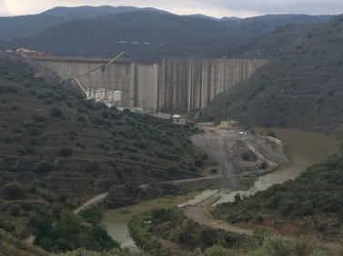
Day 24 Andosilla - Yanguas 37 miles. Today was a very hard day, both physically and mentally. There were some big hills and the knee problem was still present. I ran downhill through a green fertile valley thinking that I was nearing Yanguas, but I wasn't. There were Griffon Vultures circling overhead that made for a somewhat ominous feel, especially as I felt near to collapse. The valley opened out and in front of me was a huge dam under construction. The road ahead wound uphill past the dam and it looked as though it would defeat me. I was surprised at how well, apart from my knee, that my body had stood up to the stress I had put it through but here it began to unravel. I sat down at the roadside and sobbed, I was utterly spent.
But, I gave myself that moment, then had a strong word with myself, 'Get up! No-one is going to help you, just get a grip'. I did and made it to Yanguas and my accommodation at Cerezos de Yanguas.
First thing - 'Can I have a bag of ice please?'
It was a rural hotel, named after the cherry trees in its garden, and just what I needed. I went through my usual routine of clean & repair and then went for food, it was magnificent. Wild boar stew followed by rice pudding. It was a real morale booster and the good food replaced the energy I had lost that day.
The owner sat with me for a while and we had an interesting conversation, thankfully his English was much better than my Spanish:
'Do you know Bradford?' he asked
'Yes, I do'
'I went to university there, what do you think of the place?'
I gave him my honest opinion, which was not entirely positive, and he agreed, he was glad to be back in Spain!
So, there I was in a small rural village in the Soria Province of Spain having a conversation about Bradford, it seemed quite surreal.
Dam - Rio Cidacos

Sanctuary!

Yanguas

Madonna del Miron Hermitage
From Yanguas I went to Soria, which I calculated was about half way on my journey. Lynn had kindly found a very pleasant place for me to stay that night. It was so upmarket it had a telephone in the bathroom next to the toilet. I was tempted to give reception a call from it but resisted, I suspected they would not see the humorous side of the request I had in mind!
The image above right is of the Madonna del Miron Hermitage dating back to the 6th century. Soria was repopulated around 1114 by king Alfonso I the Battler, which seemed quite apt given my circumstances, so I battled on ...
Day 27 Berlanga de Duero - 13 July - My 58th birthday and 'The day the Spanish ate my Breakfast'. A day I would not forget!
I had arranged a breakfast of bread & jam at 7:30am. I came downstairs to find that two Spanish cyclists had beaten me to it, and eaten my breakfast. 'Not to worry I thought, I'll find something en-route'. Today was a 44-mile day from BdD to Jadraque. I'll paraphrase; there was nowhere to get food throughout the whole day. I had an apple, an emergency gel and some nuts to see me through.
I came to a small remote village but no one was around. At the village I should have turned right but I went straight on, I was tired, rationing water, hungry and not thinking clearly. By about mile 35 I was out of water and having problems, I must have looked a sight. I came to another village and the only person I could find was an elderly lady at her house door. I managed to ask for water and she filled my two bottles with fresh water, I had even used my reserve bottle. I'm not sure what she made of the very strange Englishman arriving at her door in shorts and t-shirt looking as though he had crossed the Sahara!
I reached mile 44 and was beginning to fear I would collapse into the ditch at the side of the road and never be seen again. I had about seven miles to go because of the missed turn. An old man in a van stopped and asked me where I was going. I explained and he said that he was not going there, he would be turning off at the next cross-roads but would drop me there. I think he appreciated the condition I was in because he took me to the hostel, which was out of his way. I was so grateful to him for his help and kindness, he saved the day for me and would not accept anything for his trouble. I was absolutely drained of energy, I had used all of my reserves and really thought I would not see the end of the day. It was, on many occasions, a very emotional journey and today was no exception. I have to confess to having tears in my eyes when I climbed out of the van; relief at finishing the day still standing and for the kindness of this man.
My wife had contacted the hostel ahead of my arrival, informed them of what I was doing and that it was my birthday. That evening I had the largest and most succulent steak I have ever eaten! I needed the protein!
I never saw the Spanish cyclists, which was their good fortune!
I was now running SW towards Madrid and the temperature was rising quickly. I noted on Day 28 towards Guadalajara, 'heat intense, very weak'. My knee had improved and I had removed the support, unfortunately as I did that my left shin became very painful. I added [crepe] bandaging to my morning routine.
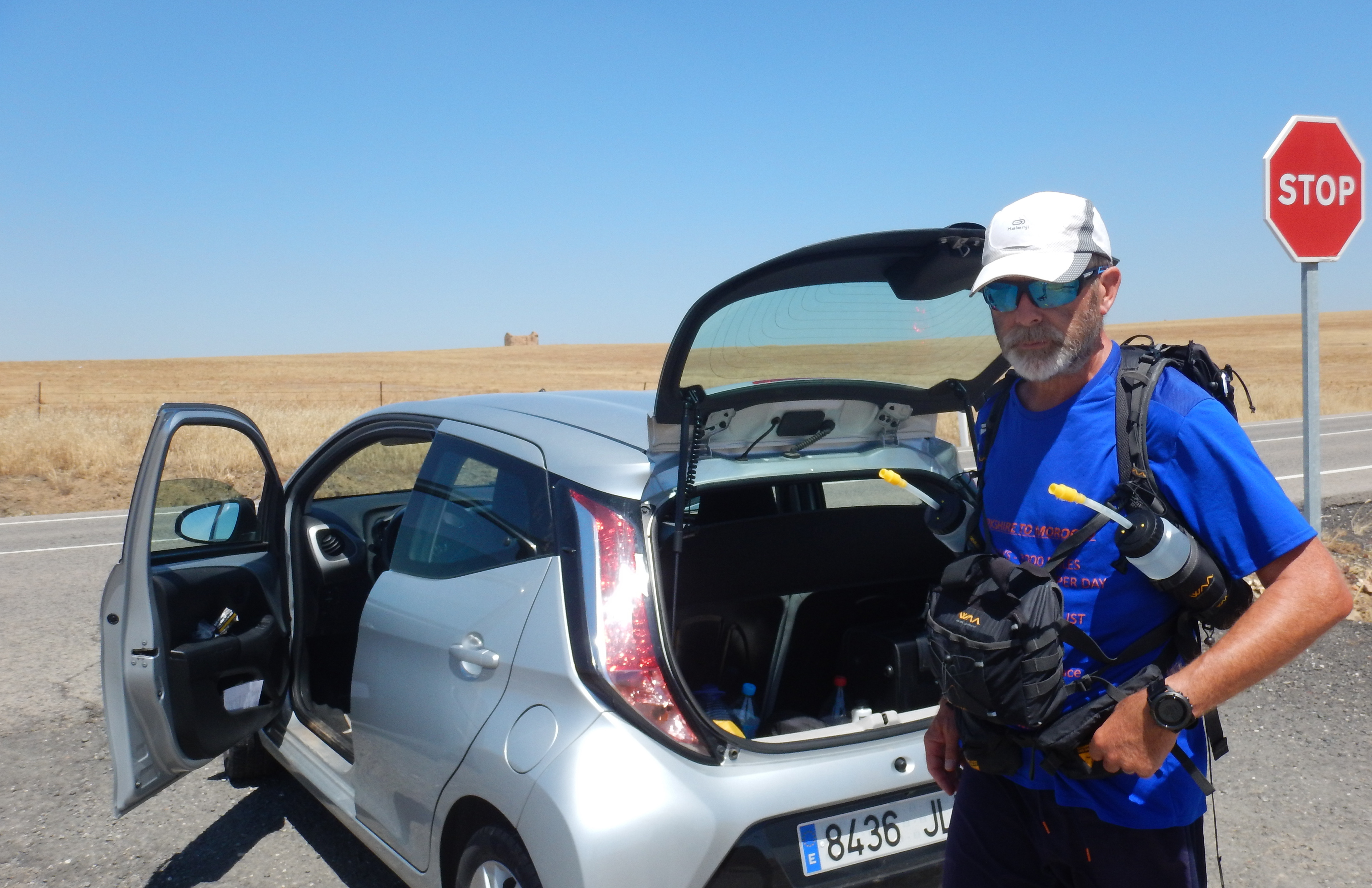
Day 30 was the day that my son, Jonathan, flew out from the UK to Madrid bringing new running shoes and a change of clothing for me. He found me in Aranjuez. He had a hire car so I was able to offload some things from my backpack and he would, periodically taking a break from his sightseeing, find me and re-supply with water and a pastry.
Near Aranjuez
Kangaroo Day: It was very hot, the roads were straight and disappeared over the horizon. As the sun heated the road surface a heat haze would blur everything ahead. In my exhausted, incoherent state I saw something coming towards me on the road ahead, shit ... it's a kangaroo! Dehydration and exhaustion can play strange tricks on the mind. Hard days became kangaroo days thereafter.
It reminded me of when I ran the Marathon des Sables; running across the dunes absolutely bushed I saw an ice cream van atop a sand dune. My mind began to imagine an ice cream cornet, a '99', cold and refreshing with chocolate sprinkles. It took a while for me to realise I was hallucinating, it was one of the white support Land Rovers; I was gutted.
The N-401 almost became my nemesis. It was long, straight and [literally] sole-destroying, it seemed to go on forever. I could see it disappearing into the horizon climbing up a wooded hillside and passing through a col that appeared so very tiny in the distance. I ran along the road-side with the heat radiating from its surface across what seemed like a barren landscape. After a number of hours, I managed to climb the hill, pass over the top and into a different world. This was downhill, thank goodness, and within a forested area so it was a little cooler. I must have been drinking sufficient as I needed to answer the call of nature and stepping off the road into the cool tree-line was heaven, with the heady, sweet smell of pine.
I really struggled to refuel on some days, especially at the end of the day's run. As I went further south and temperatures continued to climb most locals retreated indoors during the day, there was just this mad Englishman and he was running! Locals didn't re-appear until around 9pm, children still playing out at 11pm in the cool evening air. That meant that cafes did not open for food until 9pm. I would finish running about 4pm and not be able to find food. Small stores sold fruit and general foodstuff but I needed big calories. There were times when the hunger cravings actually became painful.
I reckoned that I was burning around 4000-5000 calories per day and I often struggled to find sufficient food to meet demand but I had planned for this, I knew I would be in deficit. I hoped to at least manage to eat +2500's worth each day (I lost a stone in weight) but the late eating habits of the locals didn't help as I needed plenty of sleep too.
Day 37 Ronda. I arrived at Ronda expecting a small mountain village, picturesque and charming. One disappointing thing about running into a town was that one often had to pass through the outlying industrial areas and Spain's youth seemed to plaster graffiti on every surface. I did manage to go to the tourist area and see the famous Puente Nuevo bridge and the deep gorge. Ronda is in the province of Malaga and the autonomous community of Andalusia. Muslim forces invaded the Iberian Peninsula in 711 (to 1492) and ruled what is now Andalusia (Arab: Al-Andalus) creating the amazing architecture that we see today in cities such as Granada, Cordoba and Seville.
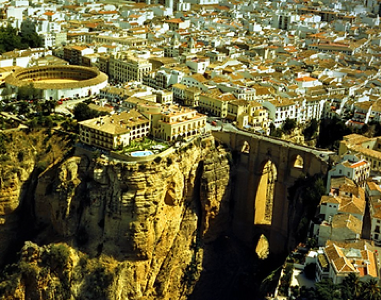
Ronda
Day 38 Ronda - Los Angeles 37 miles. From Ronda I continued generally SW towards the south coast and Algeciras. It was now getting very hot. A news item showed Cordoba having a temperature of 50C! I had to negotiate a range of mountains to San Pablo de Buceite which was on the southern side. It was a six-mile climb on a mountain road to pass over the top and begin to descend towards San Pablo. I stopped half way up the climb to use Google Maps and found that my feet were sticking to the melting road surface, I was trying to locate somewhere to find food near San Pablo. There was nothing before the town so I ran into its narrow streets to find everywhere shuttered and closed, it was as though the place had been evacuated. I asked the only person I saw if he could direct me to a bar, which he did. It was atypical, a small door into a small room. It was about 2pm and the counter had tapas. I needed calories so I simply hoovered up all the food from the bar like someone who had not eaten for days.
It was interesting that in the south of England there were many occasions when I could not get a GSM (mobile 'phone) signal. Throughout France, Spain and Morocco, even in remote countryside, I was able to get a signal.
Los Angeles to Algeciras was a steady 30 miles to the coast, a little cooler. I followed the route in my book but found the way blocked, I couldn't go the way I had planned. I picked up a road sign for Algeciras and followed the main road, which arrived at a motorway. There was no way across the estuary to reach the town other than the motorway. At the motorway entry slip there was a bus stop. It was about a mile to town so in the interests of safety, and to not be arrested for walking on a motorway, I spent €1.50 on a bus ride. A sound investment I thought.
MOROCCO
It is 8.1 miles from mainland Europe to Africa. In 1988 I drove from the UK to Morocco and crossed the straights to Tangier. Wow, what a cultural difference a strip of water 8 miles wide can make.
Sailing from Algeciras the Rock of Gibraltar was clearly visible. Gibraltar is only 2.6 square miles in size. I read that it was ceded to Great Britain, in perpetuity, under the treaty of Utrecht in 1713, an obvious strategic location. I am not a political animal but it is interesting that Spain cites a UN resolution in its attempts to regain Gibraltar, 'any colonial situation which partly or completely destroys the national unity and territorial integrity of a country is incompatible ...' but Spain will not accept such a premise when it comes to its holding of Ceuta and Melilla on the North African coast, within the territory of Morocco.
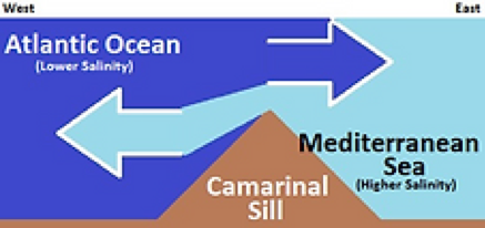
Researching the area one travels can unearth some little gems of information; the Camarinal Sill separates the Atlantic Ocean and the Mediterranean Sea at the strait. The differing salinity helps to create an inflow and outflow at different levels. Crafty German U-boat captains during WW2 used the flows to enter and leave the Mediterranean Sea without using engines and thus avoid detection by the Royal Navy.
There is now a new port, Tangier Med2, which is east of Tangier, it's huge and full of new Renault and Dacia cars headed for European showrooms. I had arrived in good time to board the Balearia ferry but to my dismay found it was delayed by three and a half hours. I had a 38-mile run from the port to Dar Chaoui in the Rif Mountains and was becoming concerned. I eventually arrived in Morocco at 3pm. I have a rule when in Africa; don't travel at night. I broke this rule to near disaster.
Navigating in Morocco was not that easy but I managed to stay on route and not get lost, following the coast road west before turning SW at Ksar el Majaz. The older Jebala women were wearing traditional straw hats adorned with coloured stripes and red & white foutas.
As I travelled in the Rif I found somewhere to get some food but then darkness began to fall. I contemplated just stopping off-the-road overnight but small settlements had dogs barking and I wanted to avoid them. There was a point where the main A4 route to Tangier ran parallel with the road I was on (P4613) and I could see what looked like a service area lit up ahead. There was a high wall bordering the site which I could not climb over, so I followed it hoping for a gap. As I did so I came upon a service vehicle parked next to the wall. As I passed between that and the wall I suddenly became aware of a large dog laid down by the front wheel, obviously guarding the vehicle. It saw me, stood up and started snarling, teeth bared. I began to slowly back away but it launched itself into the air. Without exaggeration, it flew through the air towards my face, I thought, 'This is it'. It stopped-dead in mid-air on the end of a chain, inches from my face. Had it reached me that would have been the end of Y2M, and possibly me. Rabies is endemic in Morocco. It haunted me for days after.
I found a room for the night and tried to forget about the close encounter. The following morning, I was up and off and heading SW from the Mediterranean coast to the Atlantic. Whilst the roads had an extended side-strip of tarmacadam that I could run along, against oncoming traffic, it soon became quite dangerous. Cars travelling from behind me, overtaking slower moving HGVs, were coming very close very quickly. A couple of wing mirrors clipped my elbow, I wasn't sure whether I became a 'let's see how close we can get' game. I did eventually clear this particular section of road and felt a little safer.
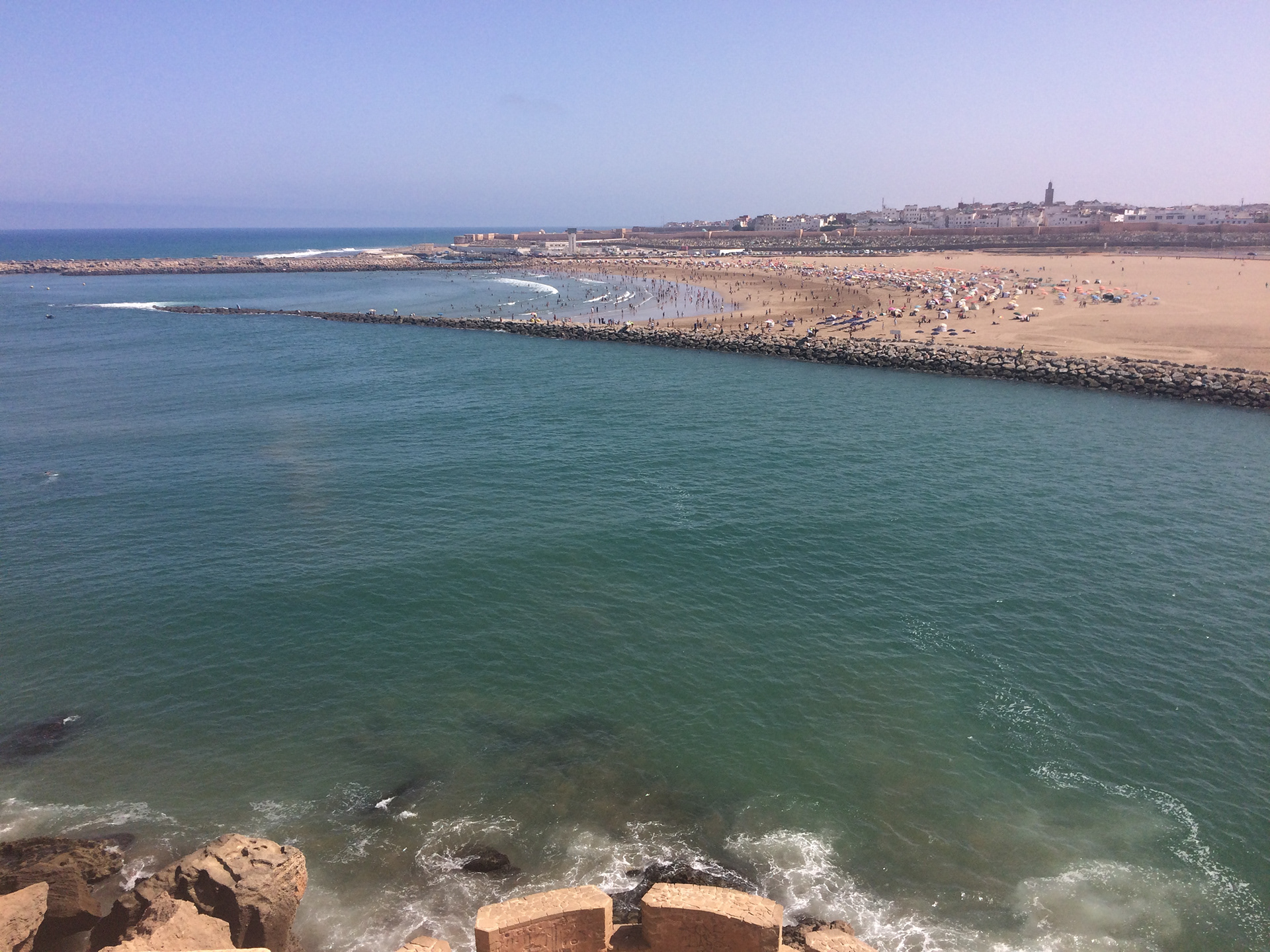
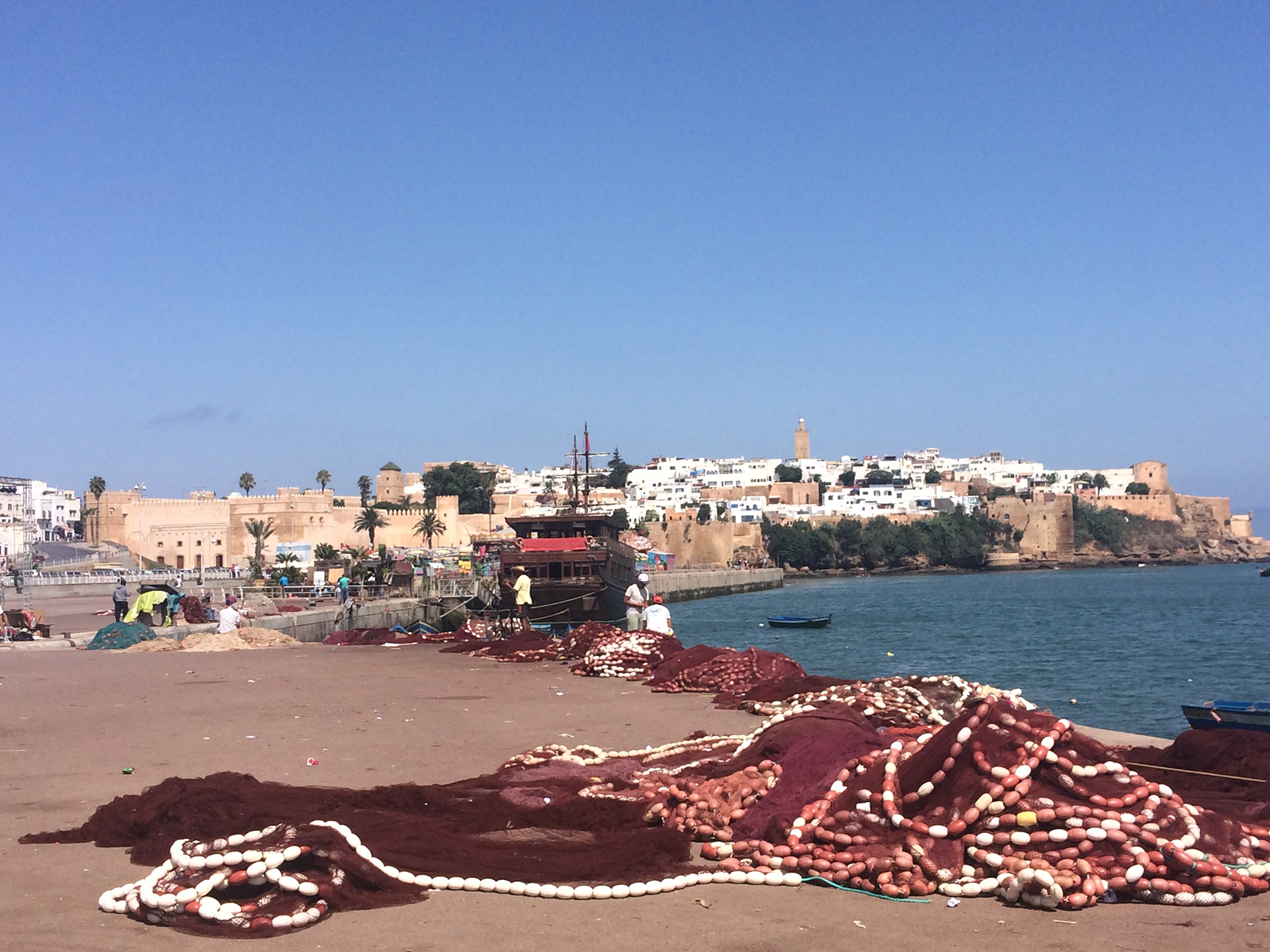
I reached Rabat via Larache. Being the capital Rabat is a growing modern city with tall buildings overshadowing the mosques and minarets. Rabat is at the mouth of the Bou Regreg, which I crossed to enter the city. The local administration is trying to encourage the population to move into newly built accommodation but somehow it seems to be changing the whole cultural dynamic of the city. I suppose it's progress.
It was Throne Day, 23 July, the day that King Mohammed VI ascended to the throne. Flags were flying and everyone was celebrating. My room was in the medina (old town) and it took some finding in and amongst the narrow alleyways.
Bou Regreg
Medina
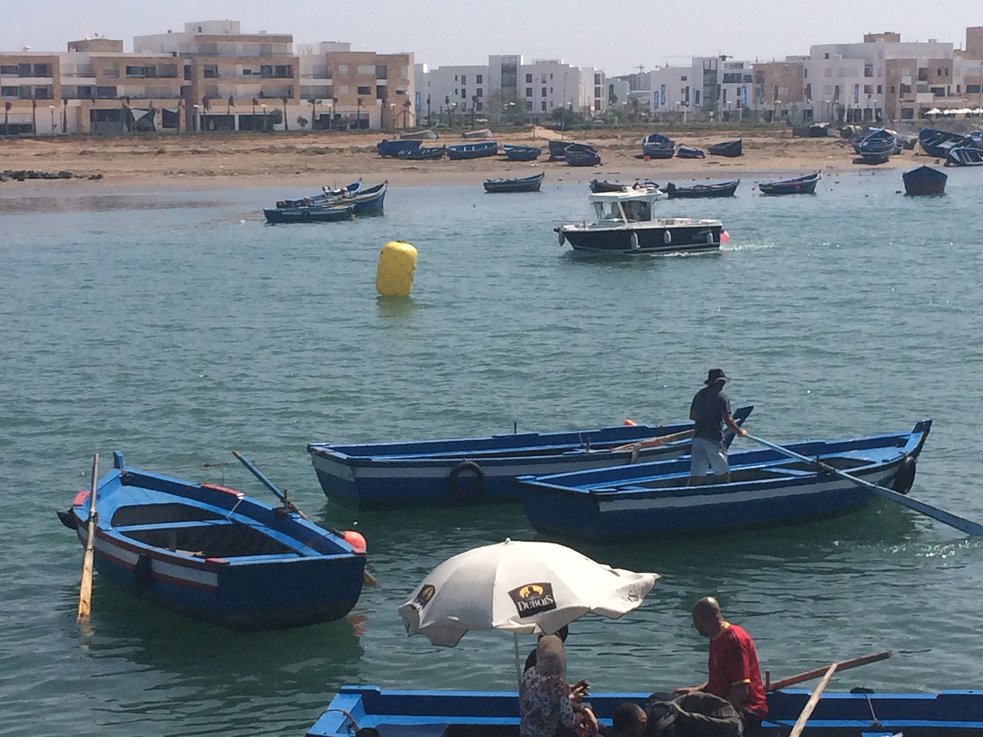
Rabat - Bou Regreg
Rabat - Marrakech. I had planned to go roughly SE from Rabat but decided to continue south down the coast towards Casablanca then cut SE to the N9, the main route between Casablanca and Marrakech. I was really beginning to feel as though I had used my reserves and so remaining on the N9 would give better access to supplies, and help, if something went wrong. Also, it was cooler at the coast.
Rabat was building a huge promenade south from the city as part of its modernisation but it was still full of litter and waste. As I reached the outskirts of the city, on the coast road, there were large houses with large gated grounds facing onto the sea some with armed guards at the gates. Obviously the more affluent neighbourhood and in complete contrast to the medina
It became a case of, 'Just keep going Ian'. Energy reserves were low and Marrakech became my focal point. However, travel is never without its moments;
I was running along the N9, beyond Settat. A young Moroccan chap on a pedal cycle with some panniers rode past me in the direction of Marrakech. We waved, he turned around and stopped. He asked if I would like some cold water as he had plenty, he was riding to Marrakech. I had just replenished my water so declined his kind offer. After a brief chat he went on his way ... followed by a young man on a moped, with a freezer box on the back and the rest of the cyclist’s equipment. So that's how it's done. I had missed a trick!
I reached a point on Day 46, when I 'bonked' big time and needed food. I came upon a roadside food outlet, a hut with tagine on a charcoal brazier, so I stopped to refuel. What I realised some time later was that it was the spot at which I had intended to overnight. As chance would have it missing the halt (increasing the day's mileage) led to my next encounter;
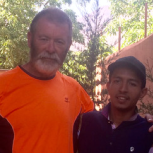
Again, running along the N9 near to Khemisset Chaoui a truck pulled out of a gateway from a building that stood on its own. On the roadside was Khalid. He asked if I would like some tea and I accepted. He took me into his house and introduced me to his three sons, two aged about 4yrs and one 14yrs, who spoke French. So, we sat and I had tea, the youngsters were playing skittle with shotgun cartridges. Khalid asked if I would like something to eat, which I also accepted, and his wife brought food. During this time a three-way conversation was being held; me to son (French) / son to father (Berber) / father to son / son to me; it did work! During this time Khalid was consuming tins of beer and showed me some images on his 'phone of the animals he had shot. I had said I was running to Marrakech and after some time said I must leave. Khalid insisted I went in his car, an old Mercedes saloon, and I couldn't refuse. My rucksack was put in the boot, Khalid opened another tin of beer and got into the driver's seat, I the passenger and buckled up. He drove me on the N9 writing his mobile number on paper as he drove, waving at a police officer as we travelled through a check point. We stopped at a cafe, had coffee which he would not let me pay for, got back in the car, raced on for 200 meters, screeched to a halt and that was the end of the journey, just another day in Morocco! Moroccan (Berber) hospitality is renowned. Khalid, obviously, did not know me but he extended kindness to a stranger. So it was a balance, to not offend that kindness against being driven a few miles towards Marrakech. I chose the latter and didn't worry about it.
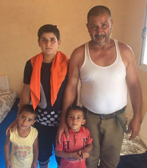
Khalid Maknoun
I had been carrying a Scout neckerchief from Brownsea Island given to me in Portsmouth. Brownsea Island was where Baden-Powell held his Experimental Camp for Boys in 1907 and from which the Scout Movement began. I presented this to Khalid's son to say 'Thank You' for the family's hospitality and kindness.
So, I arrived in Marrakech, it was 43C and I was concerned about my depleting energy levels. I know 43C sounds excessive but I seem to have an ability to manage heat, I think my DNA is sequenced differently, but this was fatiguing. I spent the night in an old haunt, the Equity Point Hostel, which is in the Medina. A large chicken tagine, plenty of fluids and the opportunity to tend my aches, pains and sores brought some semblance of feel good back.
FLUIDS
I had two 750ml water bottles that I had on chest straps that enabled me to access water quickly and easily and therefore to drink 'little & often'. I carried an emergency bottle in my pack. I also had a chest bag, as part of the ultra-bag system, which could hold, horizontally, a 1.5 litre bottle of water to which I attached a drinking tube. I drank a 750ml bottle about every hour. One advantage of remaining on roads was the availability of garages which always had water. I drank over 5 litres during the running day and then rehydrated further during the evening, sometimes up to 10 litres a day. I also had a water purifying 'pen' that Jonathan had brought out, just in case.
Hyponatremia is a low sodium concentration in the blood. Severe symptoms include confusion, seizures and coma; I had certainly suffered from confusion! Low volume hyponatremia can be brought about by sweating but also by drinking large amounts of fluid and effectively flushing the body's salts out. Whilst dehydration was a concern, so was hyponatremia. I made every effort to have additional salt via, nuts, crisps and with food in addition sourcing 'high value' food and fruit, especially bananas for potassium. I think overall, I managed to get the balance right, but leaving Marrakech to head to the High Atlas I was feeling more tired than ever. It would have been interesting to have some blood samples analysed to see how well I was managing this.
Another area of note in respect of ultra-distance running was the effect it could have on one's kidneys. It is, in broad terms, where kidneys can't filter waste from the blood and therefore making it difficult for them to help balance body fluids and electrolytes, including sodium, potassium and calcium. This can, potentially, lead to kidney damage or failure. When muscle breaks apart under exercise it releases higher levels of myoglobin which can block the filters of our kidneys, with serious consequences. So, a number of contributing factors but the bottom line; if your urine starts to look like cola you need to act.
Marrakech is one of the Imperial Cities. It has grown tremendously since my first visit in the late 80's but I find its history, and that of Morocco, fascinating. Founded in 1070 it has been the site of many battles, notably between the Almohads and Almoravids. The Rise and Fall of the House of Glaoua by Gavin Maxwell and Morocco that was by Walter B Harris are two favourite reads.
Sitting on the roof of a house in Marrakech on a warm spring morning, having breakfast looking south to the snow-capped High Atlas Mountains is a very pleasant experience. Alas, not something I could do this time.
I now had a long push into the mountains, Day 49. I set off especially early to make some headway before the temperature soared. The road from Marrakech to Asni has plenty of small roadside kiosks. I stopped at alternate ones and bought water and a coke, which helped retain my bottled supplies for later.
Tahnaout is a fairly large town with plenty of amenities so I was able to take on some food there. I was feeling especially fatigued by the time I arrived at the town and was really struggling mentally, and physically. It was nearing mid-day and the temperature was rising dramatically. I was acutely aware of ensuring I was hydrated but also that I had sufficient fuel to keep my engine going for the final leg. I knew that once I arrived in Imlil Mohammed and Mustapha would take care of me and I would be able to replace my lost fuel reserves. It was a case of digging deep and pushing on, one step at a time.
The road from Asni to Imlil; when you drive along the road the hills never seem very steep, but when you are on foot you realise that they are. The road contours along the Mizaine valley, sometimes it is alongside the river sometimes high on the hillside. I had considered running along the valley floor but it would have been difficult terrain so remained on the road.
I reached Imlil a day ahead of schedule surprising Mohammed who was stood on the main street chatting with a group of men. I had a full growth of beard and was somewhat dishevelled, nonetheless he realised it was me and a warm Berber welcome was given.
I decided to have a much-needed rest day on Day 50 and summit Jbel Toubkal on Day 51. Imlil is at 1800m (5,900ft) and the summit at 4167m (13,671ft) so I had a significant amount of ascending to do, although the linear distance is not great. I used Day 50 to walk locally and ease out some of the muscle pain I had in preparation for the ascent.
I was well looked after at Riad Jnane Imlil by Mustapha, Mohammed and Omar. Food was plentiful and I really felt strengthened. Lahcen Errami was to accompany me on the mountain. A young man, build like a Whippet, I was debating whether to put some rocks in his rucksack to slow him down.
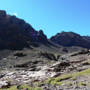
At 5:30am on Day 51 we set off to summit Toubkal and complete my challenge. The mule track was easy under foot and we made good progress. We passed through Sidi Chamharouch, a small settlement near a Muslim shrine, and continued up the Isougouane Valley to the refuge at 3207m (10,552ft).
I had my ultra-sack, it had been with me throughout my journey and I couldn't leave it behind, but it was a little lighter now. I felt really good, Lahcen kept a steady pace on the mountain path and we stopped mid-point for mint tea, Berber whiskey as the locals love to call it. Heavily laced with sugar it gave me a boost up to the refuge.
From the refuge the path rises steeply through rocks and scree and is not always easily identifiable, but Lahcen led the way. At 10:30am I stepped onto the top of Jbel Toubkal.
Lahcen and I ran to the summit in 5 hours, having stopped for tea!
I had left the refuge and was climbing up the steep, rocky path to the summit ridge when I met a group of women descending. I had my challenge t-shirt on. One of the women asked me what I was doing, in a perfect English voice. This was my final push, with almost 2000 miles behind me I was closing in on my goal. Emotion got the better of me. I could not stop myself from crying. It took a while for me to compose myself and explain to them what I had done. What a Wus!
We had some water and nuts at the summit and as always it was not without its drama;
I managed a selfie before becoming aware of a man who needed help. He was quite obviously suffering from a mixture of exhaustion, dehydration and acute mountain sickness. He was incoherent, couldn't stand unaided and when on his feet just wanted to walk to the edge to look over. I manhandled him away, his clothing was soaking so I got spare out of his rucksack and changed his top, gave him water and my final emergency gel. I got him sat down and managed to bring him out of his confused state. Leaving him with his friend, Lahcen and I set off down the mountain, he disappeared like a mountain goat. I passed the English women before the refuge.
That was it, I had completed my challenge.
3200m
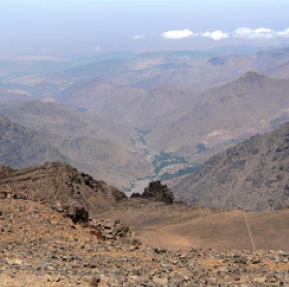
North from Toubkal
Summit 4167m
With Lahcen Errami
I raced Lahcen back down the mountain to the riad; I flew, I was elated.
After a couple of days of R&R I was taken to the airport and flew back to the UK, the flight kindly provided by Travelcounsellors. I can't really remember but I'm sure I only had my running kit to wear, albeit washed. My thanks to Richard who collected me at Manchester and saw me safely home.
51 days of running
Almost 2000 miles
5 pairs of running shoes
4000-5400 calories per day - 135 per mile - 530 per hour
6-10 litres of water per day
Almost 4,000,000 steps - 150 per minute - 9,000 per hour
Temperature high 47C
Back at home, a few days later, I went out for a short run along the canal side and past Kirkstall Abbey. It was a sunny, clear day and the canal and abbey looked resplendent, but I did miss the routine I had become used to.
Postscript. I reckon it took about 18 months to overcome the effects of the run, both physically and mentally. I found it difficult to come back to 'reality'. I wanted to put my running shoes on and carry on, where to I had no idea. I went out for runs from home to help my body cope and not have a sudden stop to the trauma it had gone through. After a while I lost interest in running and trying to motivate myself became a challenge. I suppose once you have completed something like this what do you do next?
That remains the question!