These beautiful days must enrich all my life. They do not exist as mere pictures, maps hung on walls of memory, but they saturate themselves into every part of my body and live always.
John Muir
I fervently believe that young people should be given the opportunity to travel; It broadens the mind.
Skills for Life is the strap line used by The Scouts and succinctly sums up what the Movement is all about. An expedition offers challenge, adventure and friendship. It exposes young people to managed risk they might not otherwise encounter. From this they learn about themselves and others; how to be patient, considerate and supportive. They see first-hand how difficult life is for those living in hostile environments. It creates lasting memories.
An expedition can be defined as, 'a journey with a purpose'.
The expeditions (outlined here) were planned in three phases; mountain, community project and desert for young people from Central Yorkshire Scouts, which covers the metropolitan areas of Leeds and Wakefield.
The young people taking part in an expedition to Morocco would have the opportunity to trek in the High Atlas Mountains and summit the highest peak in North Africa, Jbel Toubkal (4167m). They would support a community project in the village of El Borj in the Middle Atlas Mountains and then trek with camels in the Sahara.
The project was to support the Hannan Charity which planned to construct a school building for the village children of El Borj. Hmad and Hannah are the charities founders. They live in the UK but Hmad is a Berber from the village of El Borj. Having studied abroad, met Hannah and settled in the UK both he and Hannah understand the importance of education and seek to provide that to children in Morocco.
Every expedition leader will have their own method of working to deliver a safe, challenging and rewarding expedition for young people. There are many youth organisations, charities and commercial enterprises doing just that, in my case it's The Scouts.
In today's litigious world it is often difficult to find someone willing to put their head above the parapet and accept the responsibilities that come with the leader role but I am fortunate in having a great team of volunteers who help me make it happen.
Expeditions are not without financial cost and every effort must be made to help those who might otherwise struggle to raise the money to participate, expeditions must be accessible to all. Grants are available and I have listed two sources here – Yorkshire Schools Exploring Society and Young Explorers Trust
A timeline to expedition departure needs to consider a planning visit to the country, budget setting and any other organisational requirements. BS8848 gives guidance on how to put an expedition together and how to put those plans into a comprehensive package. It can be two years from concept to delivery.
The mountaineers amongst you will see the significance of 8848 (metres).
The Royal Geographical Society Handbook has these words; the starting point of planning an expedition is simple. Initially you need three things; a piece of paper, a pencil and a quiet corner where no one will disturb you. It goes on to say; then take a deep breath to assess honestly whether you have the skills to embark on such a commitment. In your heart you will know when you are ready to accept the responsibility of organising a project of your own ...
I have the benefit of leading previous expeditions. Before any expedition, I would re-visited where the expedition would travel to ensure nothing had changed in-country that might catch me out. I am extremely lucky to have people in Morocco who are trustworthy, competent and who will ensure safety is a priority. Having a 'fixer' in the country you are travelling is a huge advantage.
Expeditions are usually launched about 18 months before departure. This gives time for training and, importantly, time for the young people to raise the funding to participate, which is a part of the expedition experience.
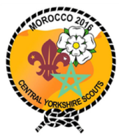
Lucia's badge design for the 2016 expedition
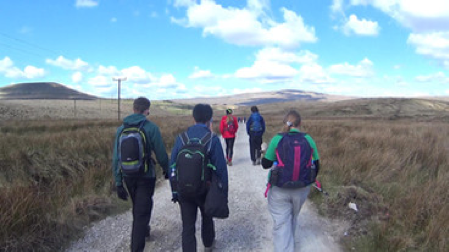
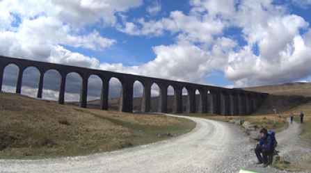
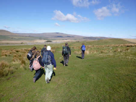
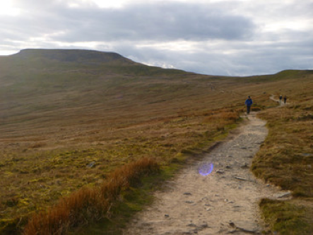
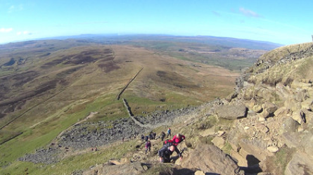
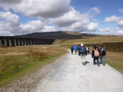
The Yorkshire Three Peaks; part of the training schedule to gauge fitness and use some of the kit, especially boots, before the expedition.
Expect the unexpected is always a good mantra.
The main 2016 party were due to arrive at Marrakech Menara airport at 9pm. I received a call to say that the flight, BA from Gatwick, was delayed. A baggage handling vehicle had collided with the side of the aircraft and put a large dent in the fuselage, which was being examined to see if the plane was fit to fly.
Everyone had to disembark and eventually the decision was made to use another aircraft, which was en-route from somewhere in Europe. There is certainly an advantage in using British Airways with a large fleet of aircraft to call upon if required.
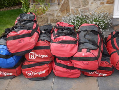
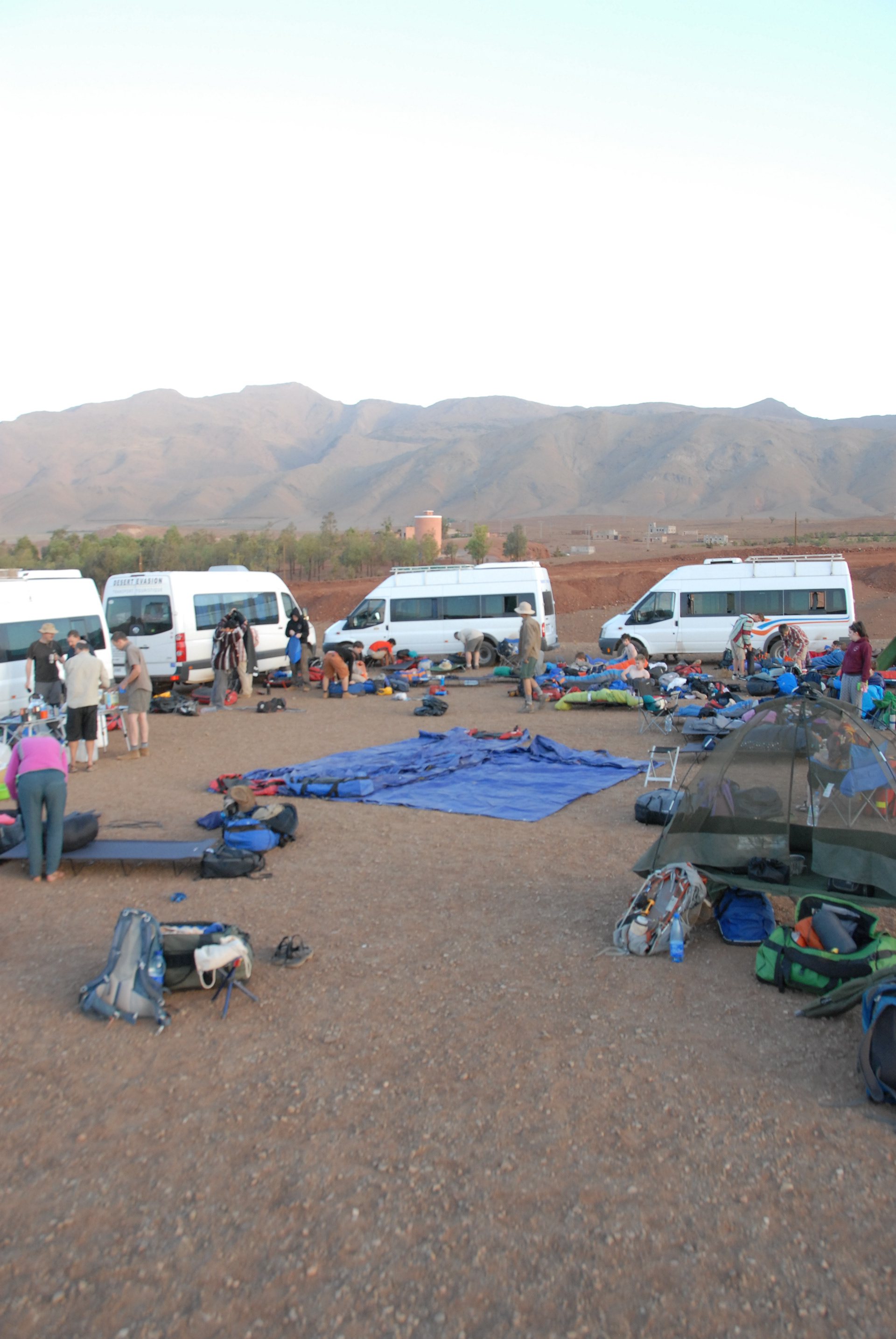
Expedition Equipment
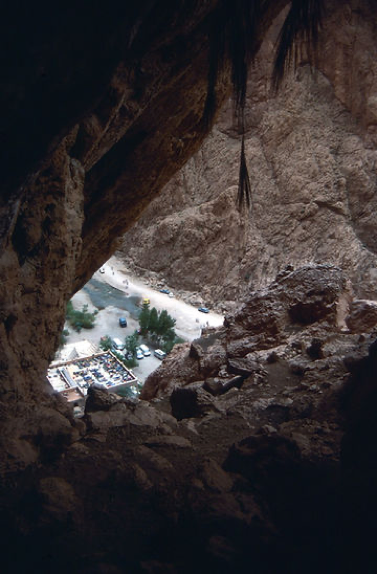
Several hours later than planned the expedition main party arrived and was transported to Base Camp at Imlil. It was dark and unfortunately the group missed the spectacular drive to the village through the Mizaine valley.
Base Camp is set in a walnut grove just outside the village on terraced land. Mustapha and Mohammed Errami are our Morocco Team and had put the camp infrastructure together for our arrival.
Whilst average summer temperatures in Marrakech are around 40C it was cooler in the mountains and walnut trees provided shade. The evening temperature in camp meant that most just slept outside on camp beds.
Morocco is not a malarial area but we advise using a 'mosi-net' to stop irritating insects disturbing a good night’s sleep. The only encounter has been with a large toad that found its way onto someone’s camp bed during the night!
Imlil is at 1800m and the summit of Toubkal is 4167m. Groups have a rest and acclimatisation day after arrival and are able to explore the village, some trying their hand at bartering in local shops.
I first went to Imlil in 1988 and it has seen great change, it now has a tarmacadam road giving easier access for tourists. Imlil is the gateway into the High Atlas and guest houses and shops catering for walkers have taken advantage of this.
Morocco is a wonderful country and the Berber are a very welcoming and friendly people. They are certainly industrious and will take any opportunity to conduct a business deal. It is a safe country to explore.
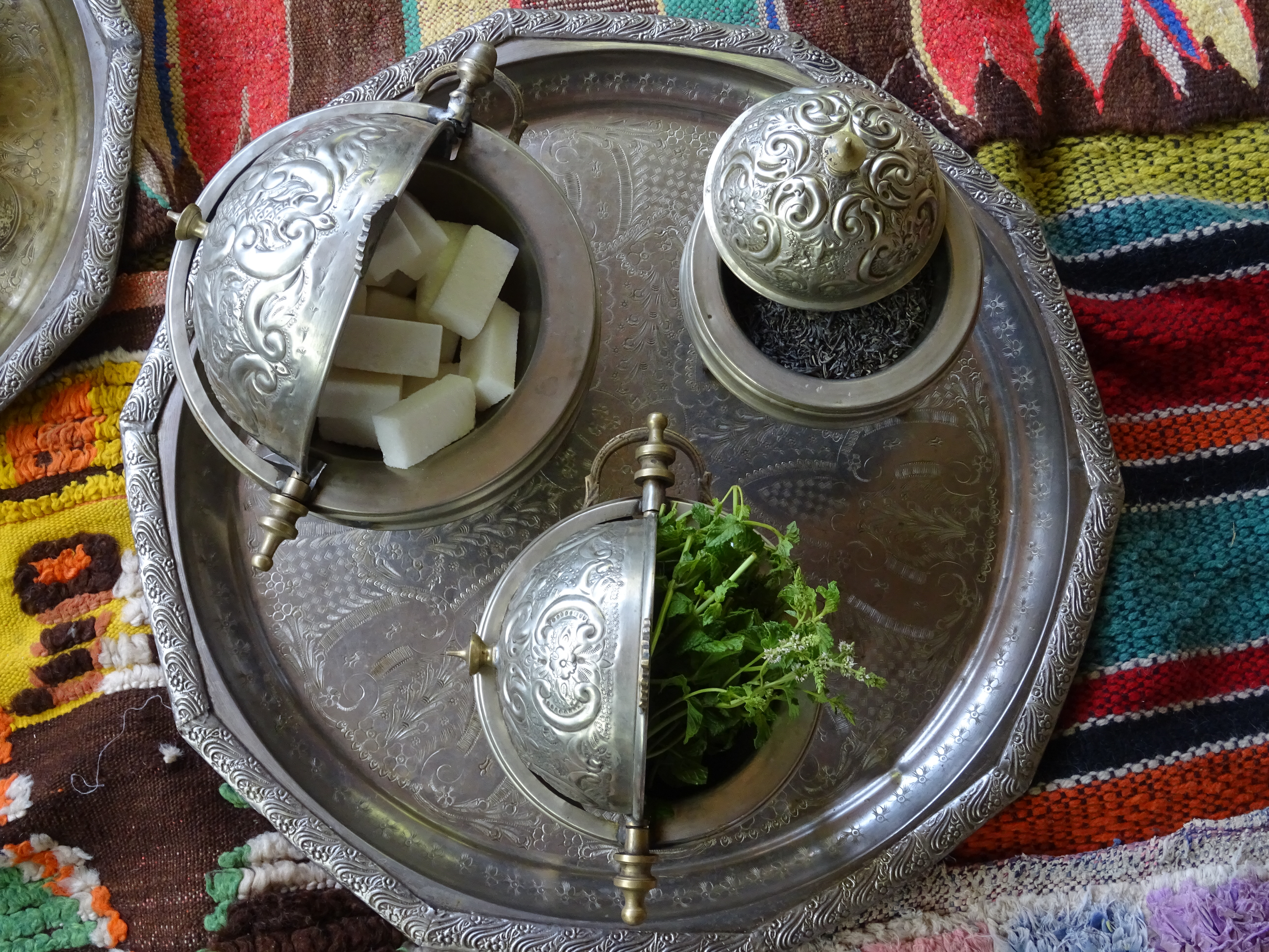
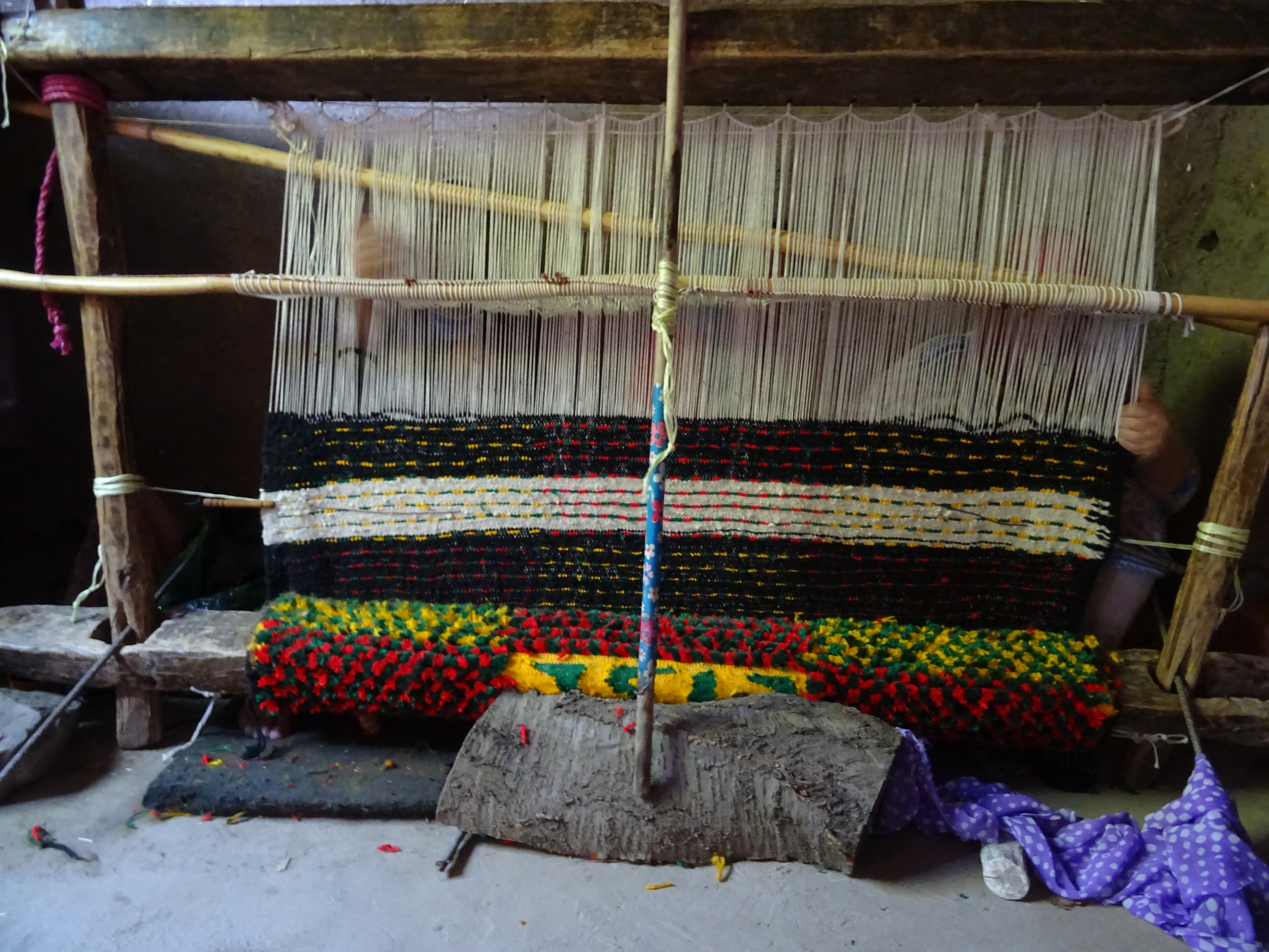
During their time in Imlil members have the opportunity to visit a Berber home, support the local community with a building project and see traditional Berber methods of weaving, bread making and, of course, making and drinking mint tea.
The journey to Toubkal begins early in the morning. Kit has to be packed and loaded onto mules to be taken to High Camp (3207m). From Base Camp the path travels through the village of Aremd and onto a floodplain.
Imlil was catastrophically flooded in August 1995 where up to 150 people were killed. A six-metre wall of water rushed down the valley washing away houses and agricultural land. It changed the layout of the village for ever.
From this floodplain the footpath to Toubkal begins. It is a well-trodden path, with many muslims trekking to the shrine at Sidi Chamharouch.
From Sidi Chamharouch, which has a number of refreshment houses, the expedition would continue up a zig-zag path to emerge onto a path that climbed gradually up the right side of the Isougouane Valley, a perfect spot for a lunch stop.
The expedition party are divided into smaller groups of eight, six young people and two leaders. They ascended the mountain in those groups, spaced from each other. I am very fortunate to have paramedics and doctors who support my expeditions. Medical bags are loaded on mules which became known as our 'medi-mules'. We did contemplate fitting a blue light and siren!
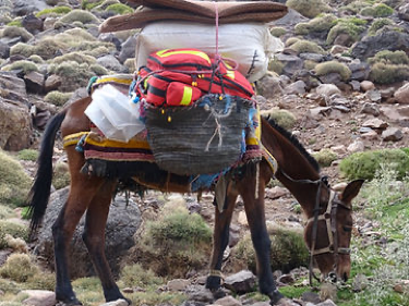
Medi-Mule
The trek from Base Camp to High Camp takes about seven hours. The mountain guides are very good at maintaining a slow and steady pace and encouraging the youngsters when they tire. Summer is not the best time to trek in Morocco because of the heat but school holidays dictate when we go, the expedition is for three weeks.
Guides are compulsory due to some fatal falls and the murder of two young women adjacent to the Toubkal path. Passports have to be presented en-route up the mountain.
The mules go ahead with some of the Moroccan team to set up camp near to the Mouflon Refuge at 3207m. Everyone would camp and whilst temperatures during the day were relatively high it could drop to freezing at night at that altitude. Afternoon storms are not uncommon and in 2014 we had damage to some tents due to a storm with high winds.
On arrival at High Camp mint tea would be ready, including the sugar rush it provided!
Toubkal is an area of volcanic rock which has been weathered into alpine crests. In summer goats are brought up the mountain to the high pasture. To the south Toubkal drops 1800m to Lac d'Ifni and to the west a pass, Tizi n'Ouanoums (3664m).
It is to this pass, or col, that the expedition trek on mountain day two to gain a little height before returning to High Camp in preparation for a summit attempt.
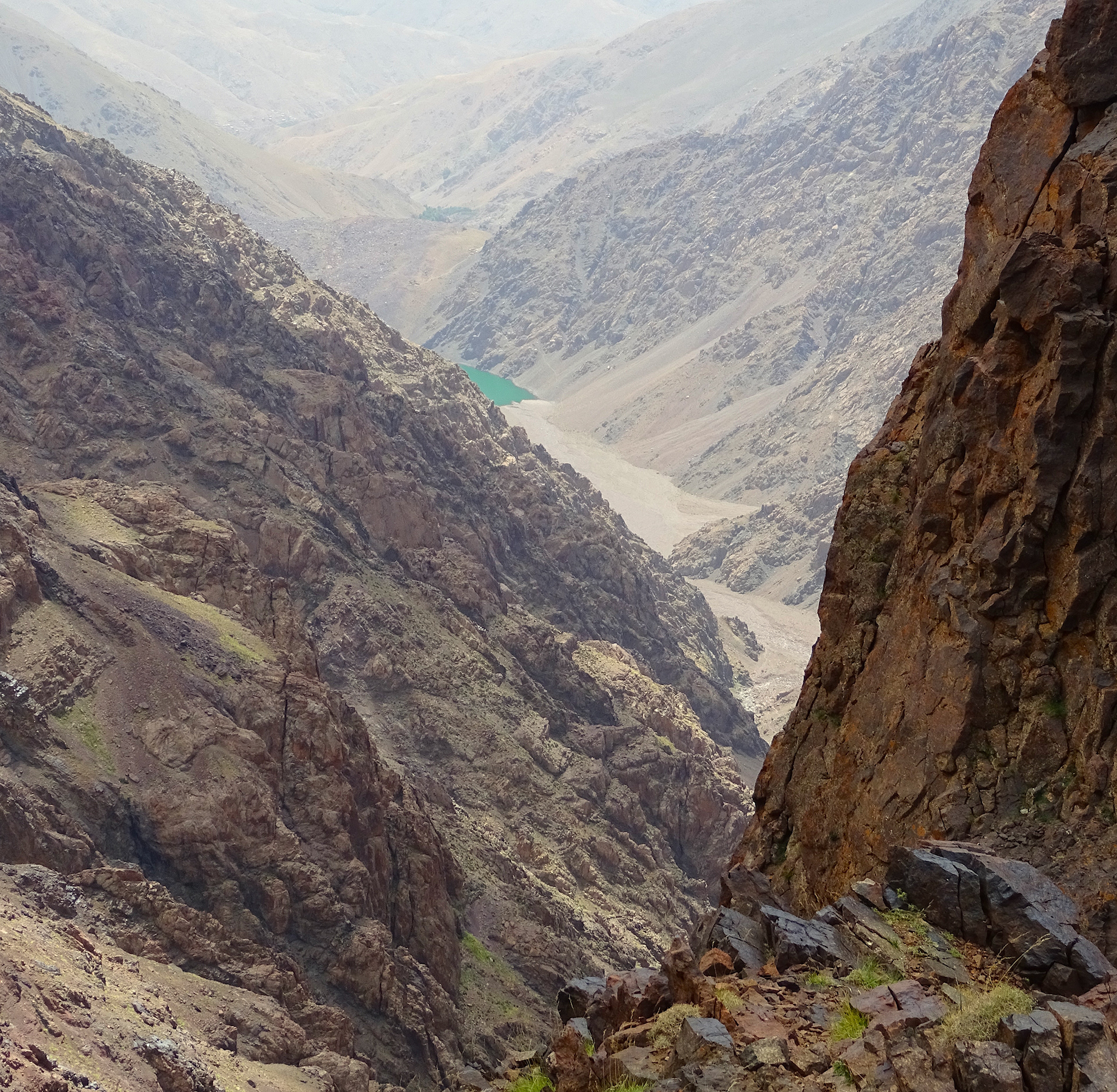
Lac d'Ifni from Tizi n'Ounanoum
An early start at 4.30am, before first light has groups ascending the steep slope to the summit. Toubkal is an 'ultra-prominent peak', being over 1500m and effectively standing alone at that height for 2000km. It takes about four hours from High Camp to summit which has a large metal trigonometric marker. Most of the members of the expedition(s) reached the summit (in groups). It was then about three hours to return to High Camp.
Having successfully climbed the mountain the expedition would return to Base Camp and a celebration meal held, gifts and thanks presented to our guides with farewells bid.
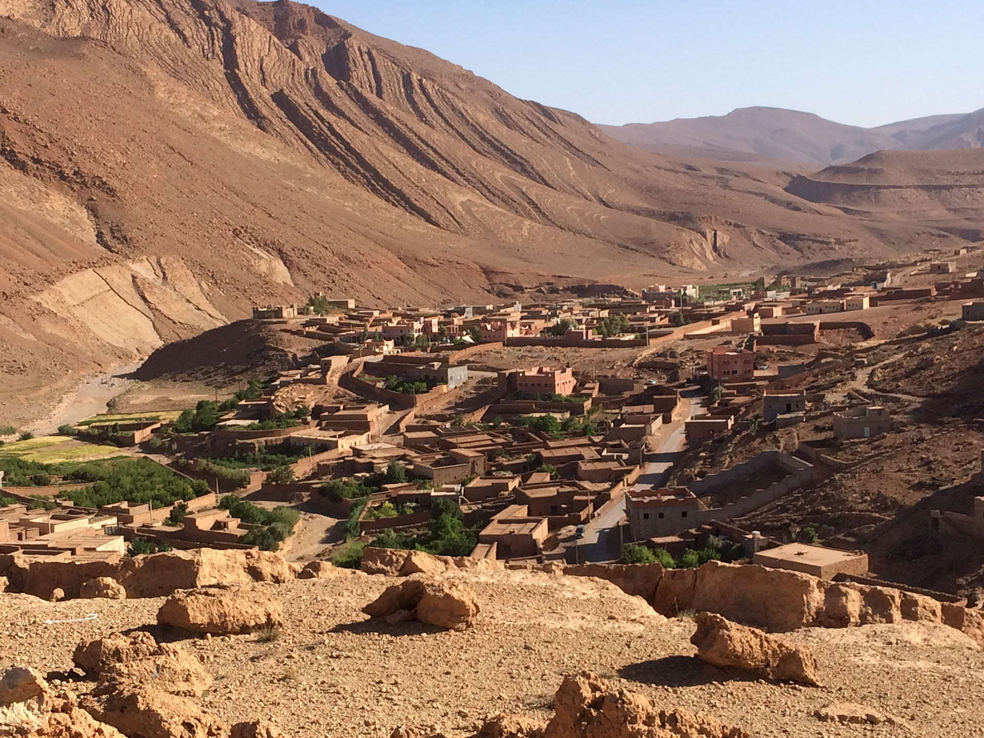
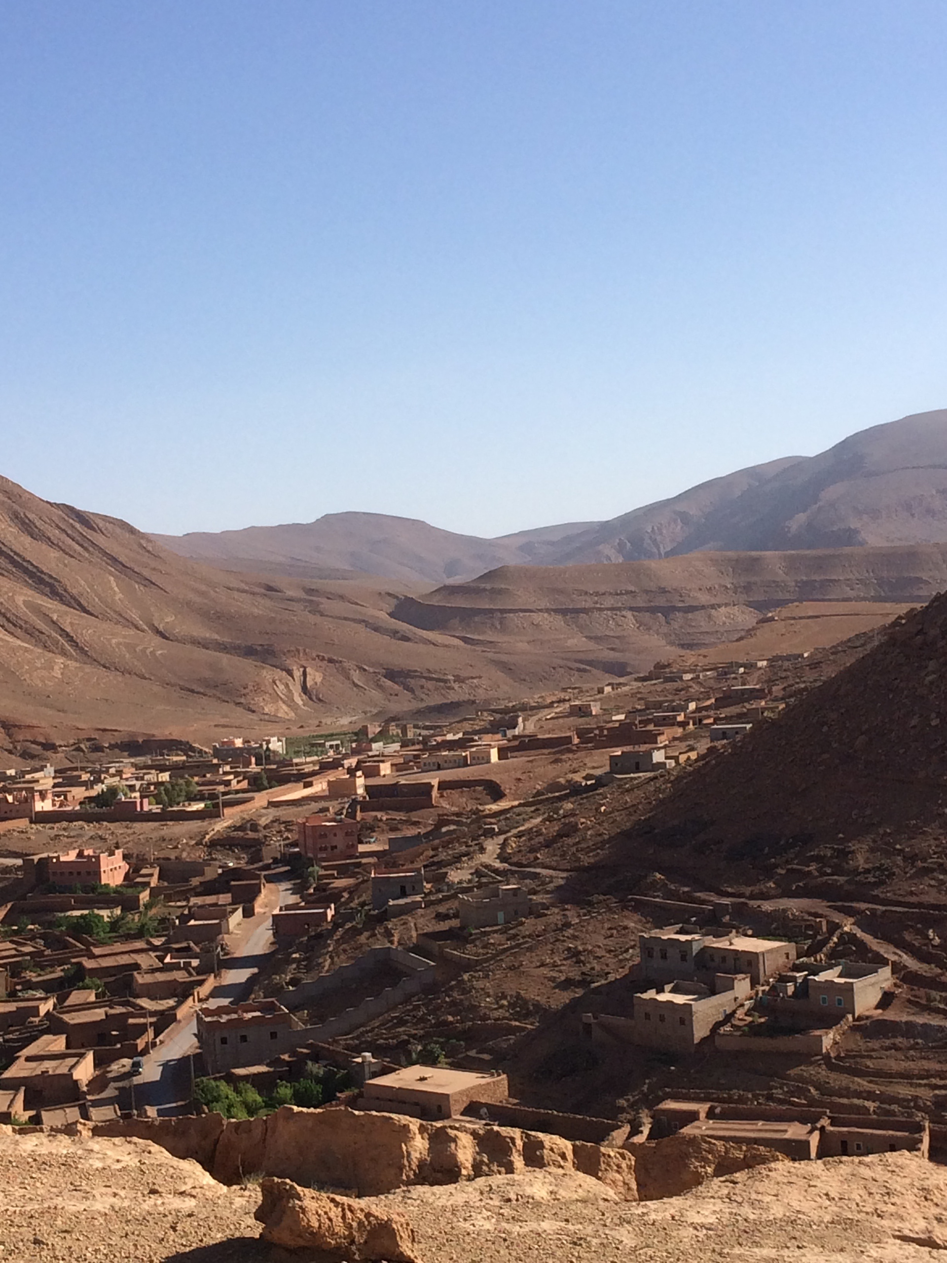
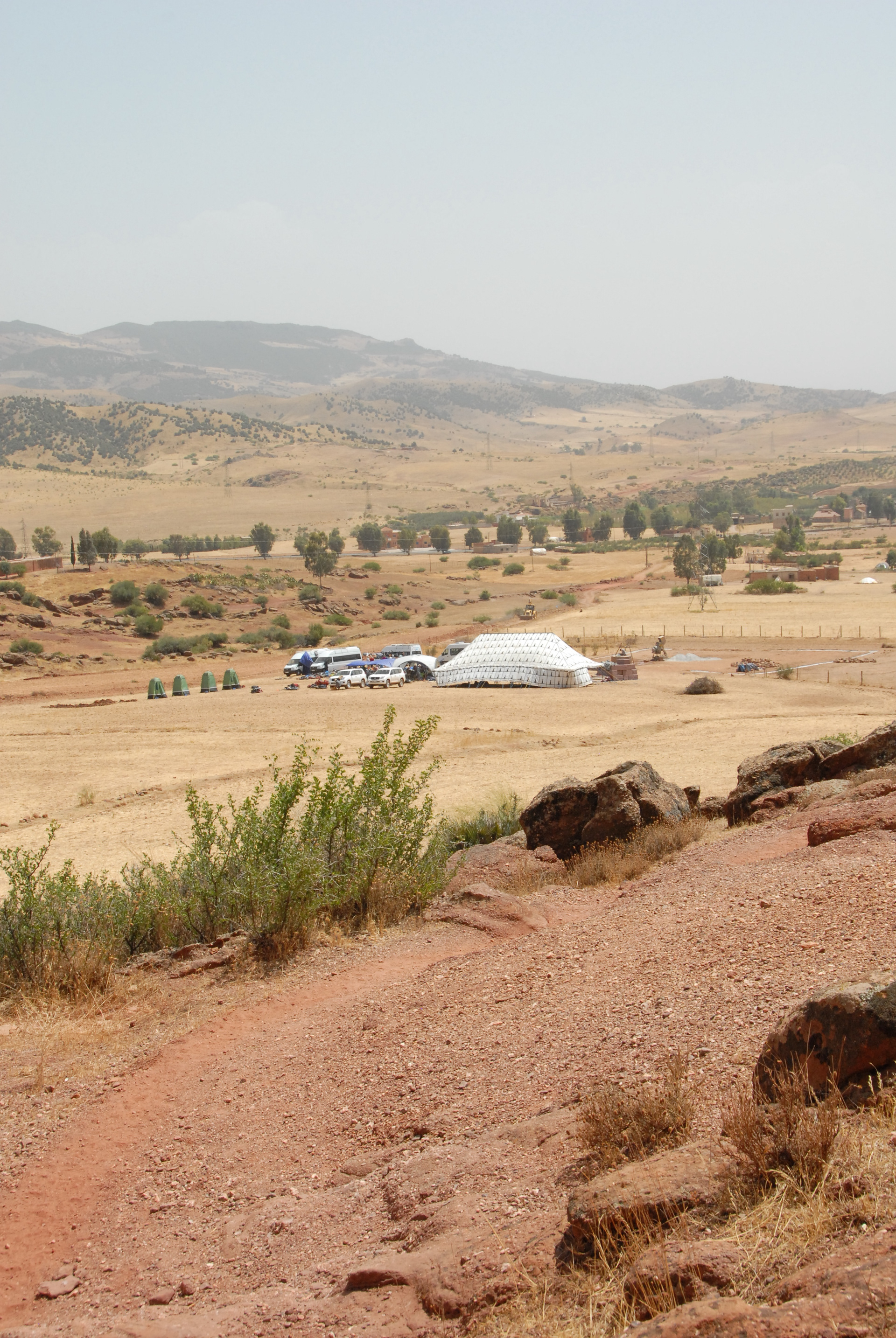
Then to the community project, a full day's drive north to the Middle Atlas Mountains and the village of El Borj, north of Khenifra.
The Middle Atlas Mountains are described as being the folds where the Tell Atlas and Saharan Atlas merge. Mainly limestone they have cedar forests, a bio-diverse ecology and are home to the Barbary macaque. It experiences more rain than the southern Atlas, which was to feature prominently for the 2016 expedition.
The area where camp is set, near to the village of El Borj, is within a shallow basin. Previously I have had thunderstorms circle the basin rim with rain seen extending to Khenifra. Because of this I asked if the village could erect a large Berber tent to provide some shelter should rain be encountered.
The 2016 project was to continue the work carried out in 2014 where concrete foundations were laid for the school building.
In 2016 all was going well, even though the concrete mixer had not materialised and meant hand mixing, when the heavens opened. Torrential rain fell, with strong winds. The Berber tent was in danger of collapse, a Coleman shelter was ripped and a large expedition tent was damaged. One of the village elders, Haddo, had a house nearby and so the expedition, apart from a few hardy souls remaining to secure the camp, were evacuated to his house. Over 40 young people and leaders stayed overnight at the house with Haddo's wife and family providing food and refreshments. Some of the youngsters found their way into the kitchen and helped with food preparation. The following day the sun shone and the work continued.
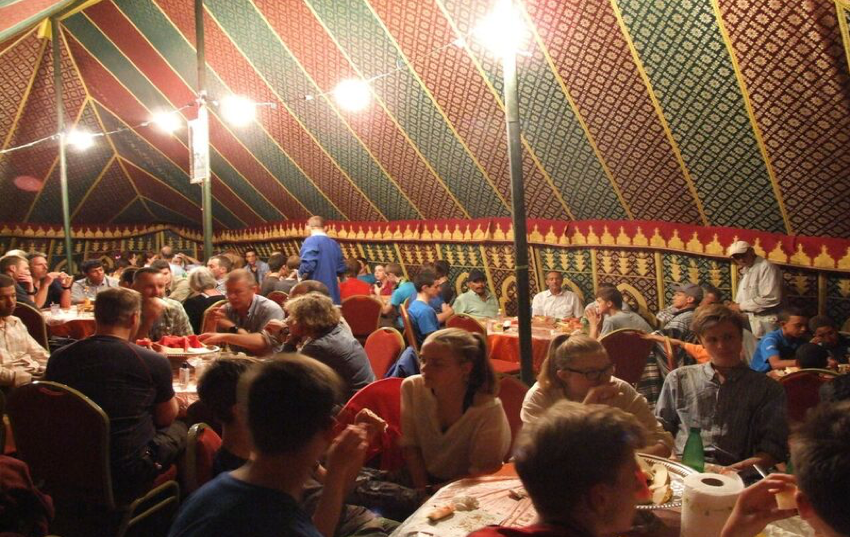
On the final evening woman from El Borj prepare food for the expedition and tables and chairs were brought to the Berber tent. A wonderful meal was served, of chicken and beef and presentations made.
It is a full and long day's drive to the desert. We would travel north to Azrou before turning south. There are butterflies here that are unique in the world.
The journey south took the expeditions through towns such as Midelt, Errachidia and Erfoud and over the High Atlas Plateaux. The N13 road travels alongside the Oued Ziz. With its source in the High Atlas it extends south into the Sahara and Algeria. It is a spectacular section to travel.
The destination was Ksar Tin Hinan, which is the base for the desert trek and named after a Tuareg Queen, sometimes referred to as 'Queen of the Hoggar'. The ksar is on the edge of Erg Chebbi, one of two large sand seas in Morocco.
Driving south from Rissani the erg comes into view across the reg or rocky desert. A left turn away from the road, across the reg, leads to the ksar.
Abdullah and Ali are our guys here. Again, most sleep outside as temperatures were significantly higher. The ksar has a flat roof which gives great views over the erg, with a tower on which is painted, Tombouctou 52 Jour. Camel caravans from the Sahara passed this way travelling north.
Part of the lead-in to an expedition is the training provided to prepare everyone for the climate and hardship to be encountered. This includes managing water intake, personal health and hygiene and the importance of 'team'. Everyone has to look out for each other. Protection from the heat, direct sun, snakes, scorpions and all other manner of things are dealt with in training. The colour of pee becomes a general topic on a morning. The NHS kindly publish a Pee Chart which is similar to the Dulux paint chart, if your colour is that of cola you have a problem!
Rissani is near to Sijilmassa a city founded in 747AD.
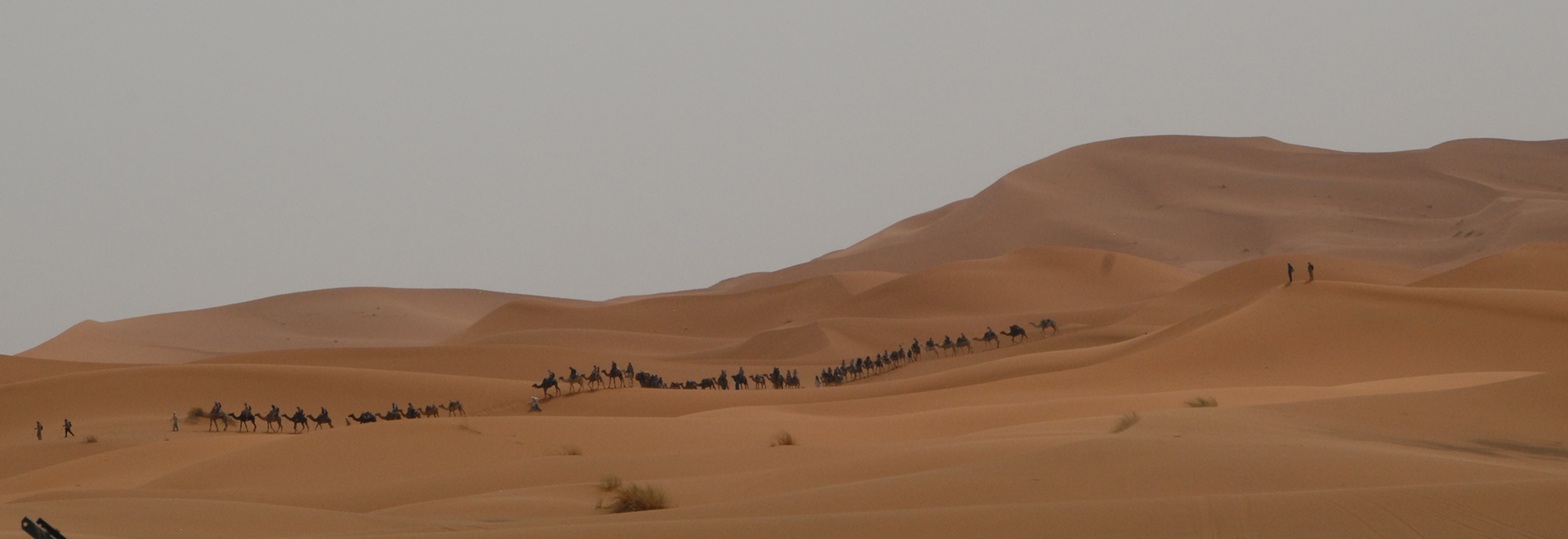
Expedition Camel Caravan of over 50 camels coming out of the desert
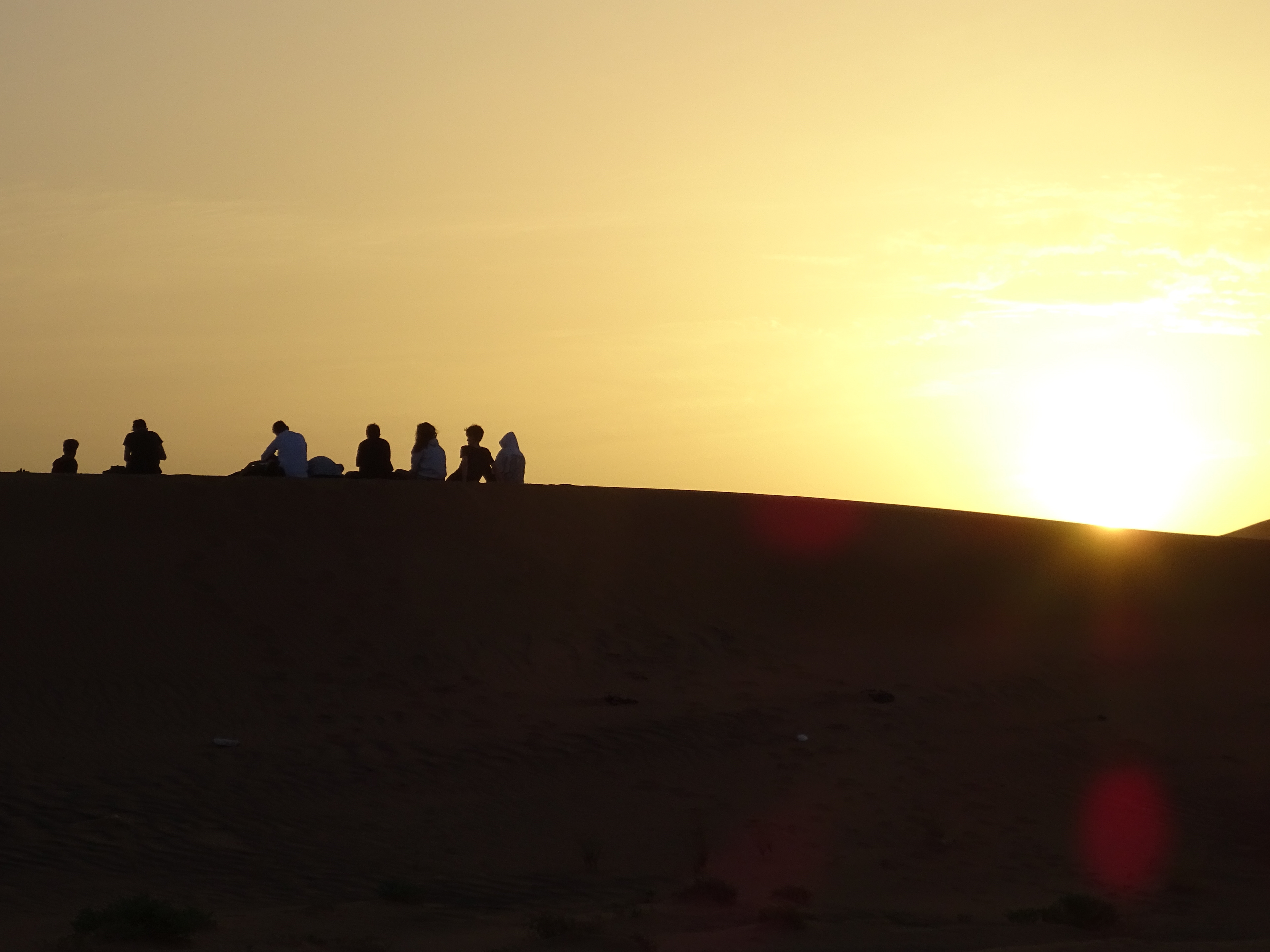
After a day of getting used to the intense heat the camels arrive at the ksar in the late afternoon with their camel-men. You can feel the excitement and trepidation in the air. The expedition has three days, with two nights bivouacking in the desert. Groups travel a clockwise and anticlockwise route through the erg meeting up on the final day to trek out of the desert as one huge caravan. It is a sight to behold.
We have experienced Berber who know the erg. I had contact with the groups whilst trekking and could extract someone quickly if necessary by 4x4 or quad. I felt it important that the expedition had the opportunity to immerse itself into the tranquillity of the desert and see how challenging life was for the nomadic Berber, hence no vehicles unless for an emergency. The young people, and leaders, were well briefed and worked as a team, looking after each other. There have been no serious cases of sunburn, sun stroke or dehydration.
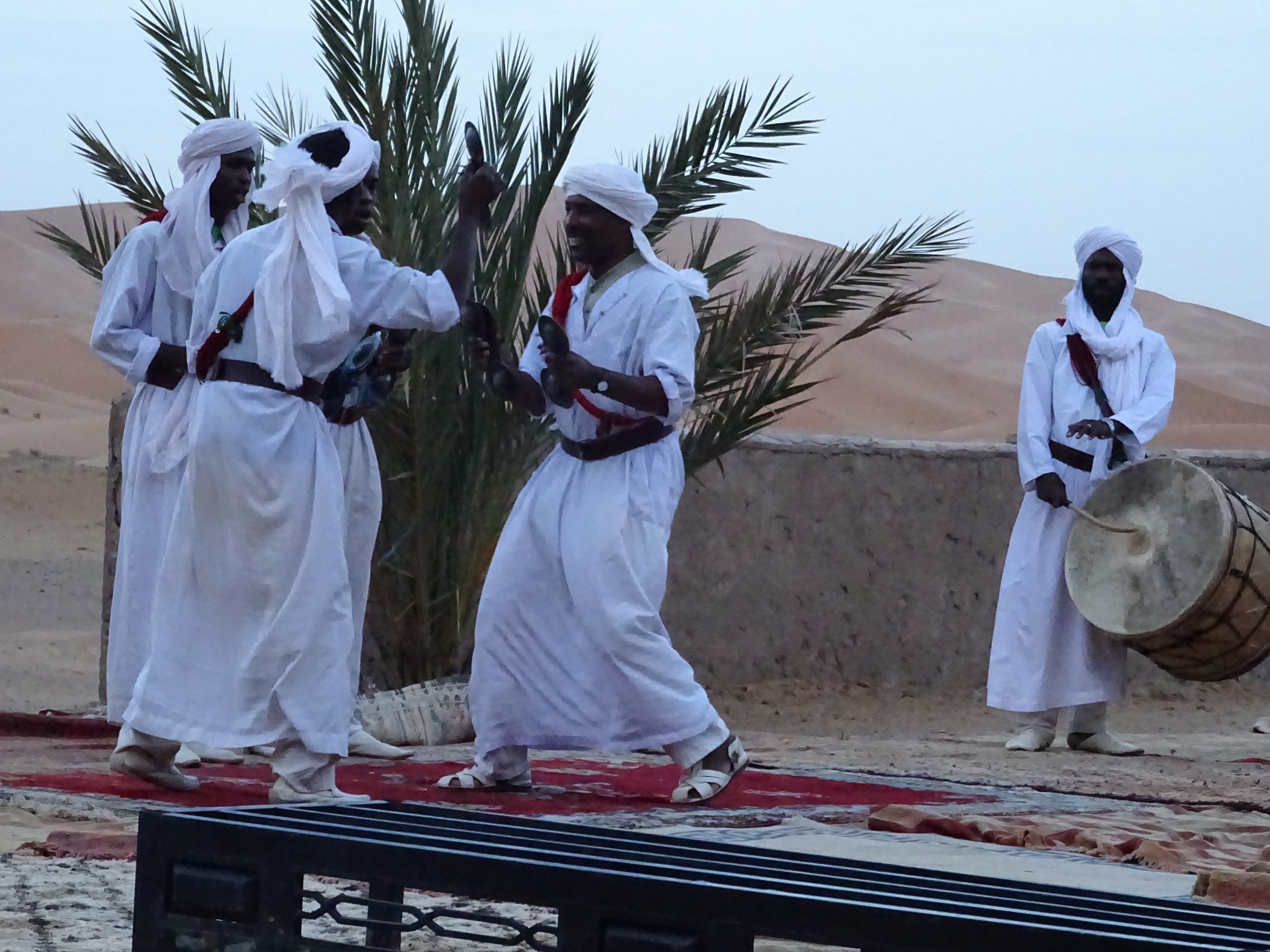
After an expedition had returned from the erg it celebrated the adventure with dinner, music and dancing. There was Pastilla made with savoury meat, spices including cinnamon, saffron and werqa dough, similar to filo pastry. Now known by all, thanks to Abdullah, as Rissani Pizza.
Gnawa music, Moroccan and sub-Saharan African, are religious songs with the musicians using krakebs which are like heavy iron cymbals to which the expedition members listened to and danced.
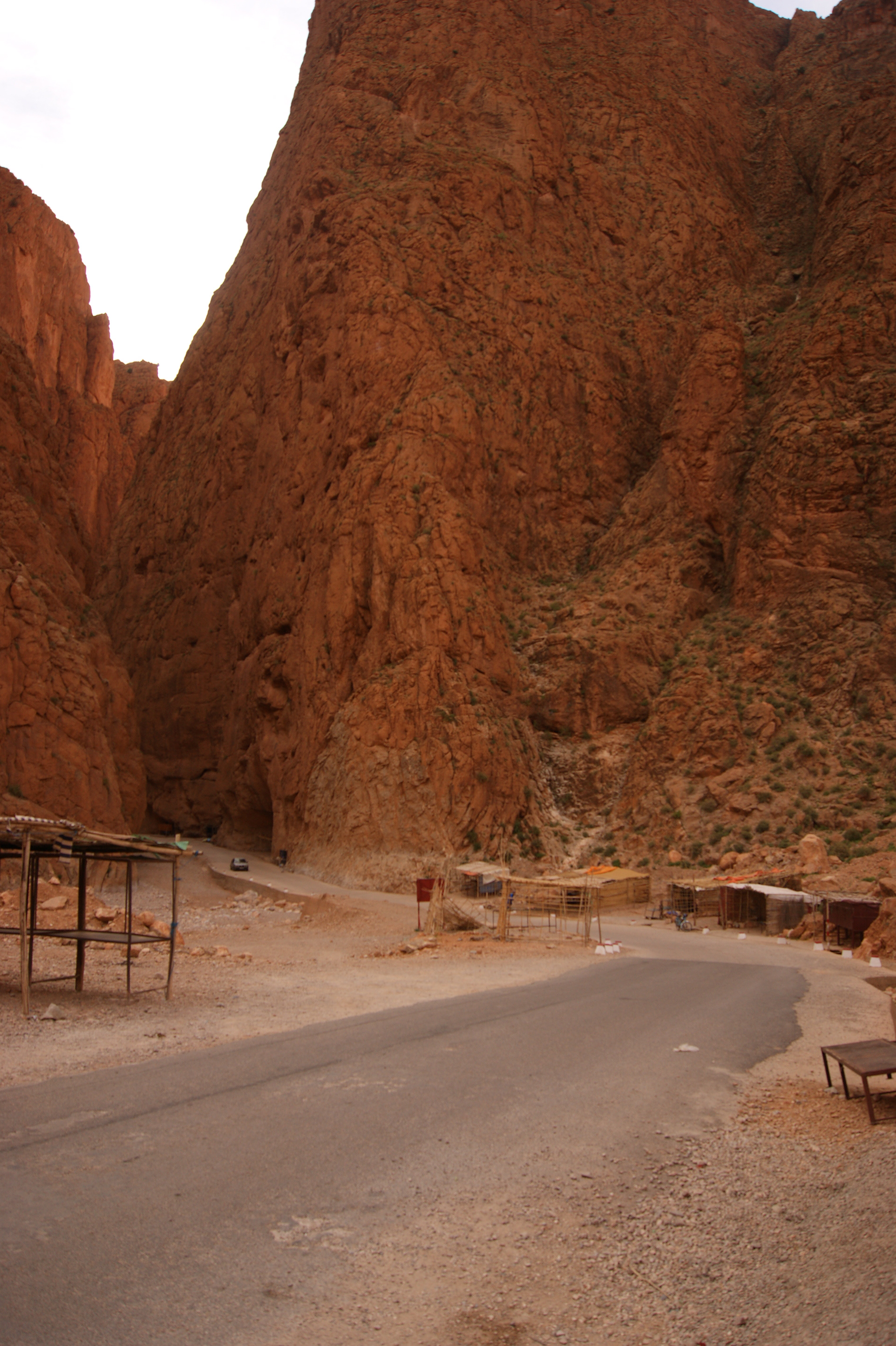
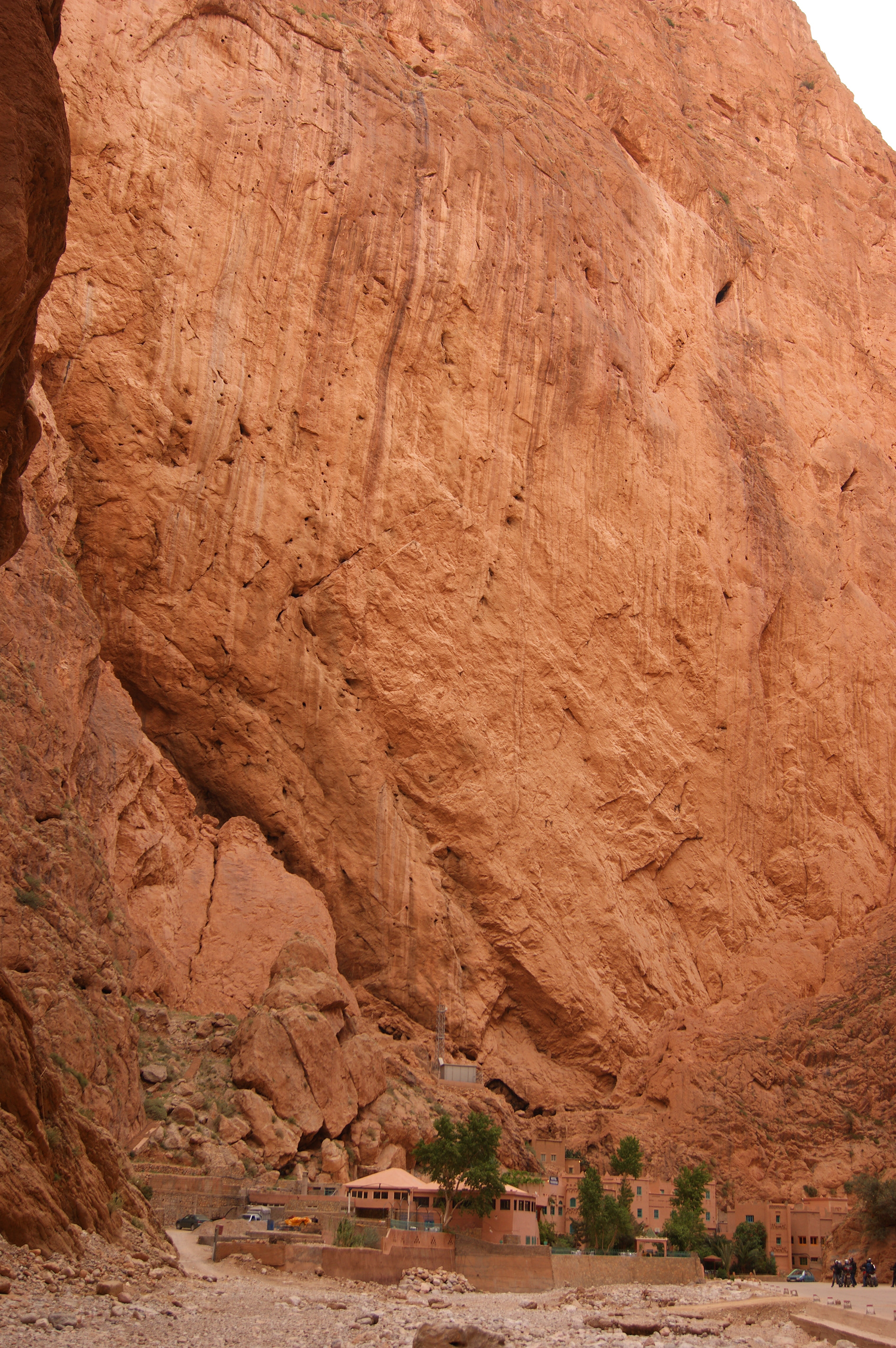
The expeditions travelled from the erg to the Todgha Gorge where they would camp overnight. What I did not tell the younger members was that the camp at Auberge Baddou near Tamtetoucht had a small swimming pool!
The gorge is spectacular. In places the walls are up to 400m high. It narrows northwards to a gap of around 10m. It is not as remote as it used to be, now having a tarmacadam road to Tamtetoucht and beyond.
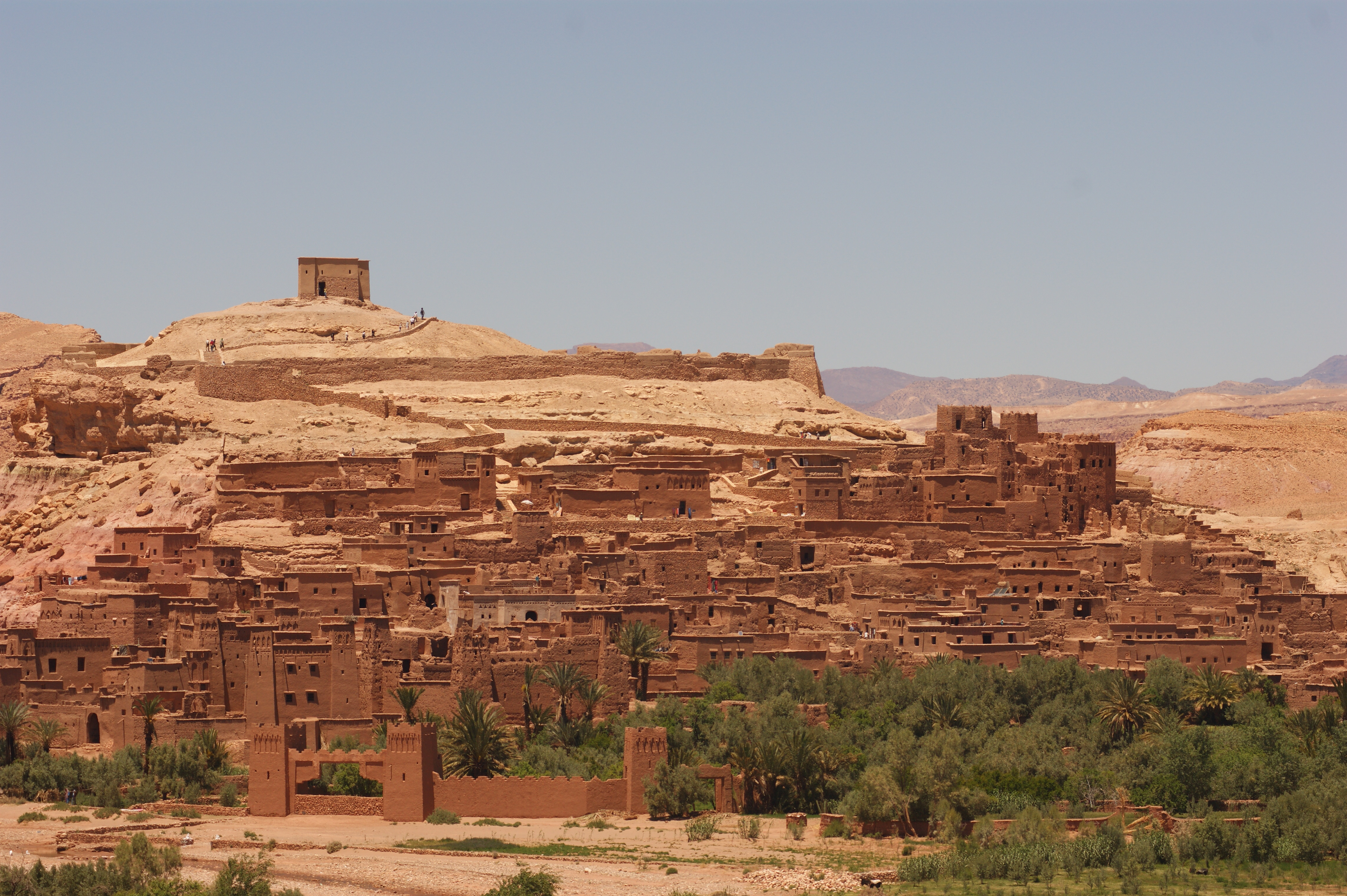
From Todgha Gorge the party headed along the Dades valley via Ouarzazate, which is the main southern city. It was once a military town but is now the gateway to the desert. It is to here that competitors for the Marathon des Sables fly. Through Ouarzazate and then away from the main road to Marrakech to [Ksar] Ait Benhaddou.
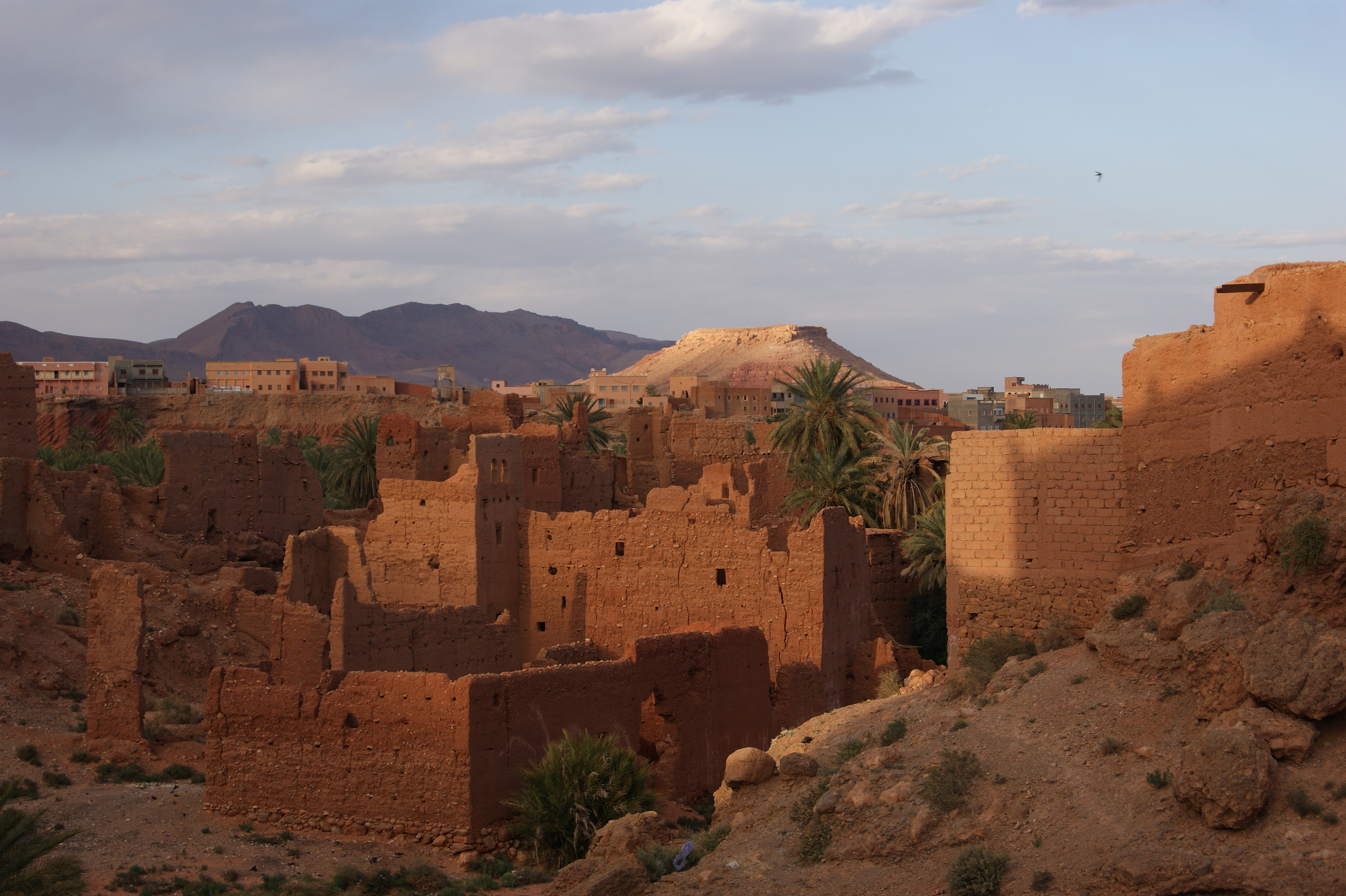
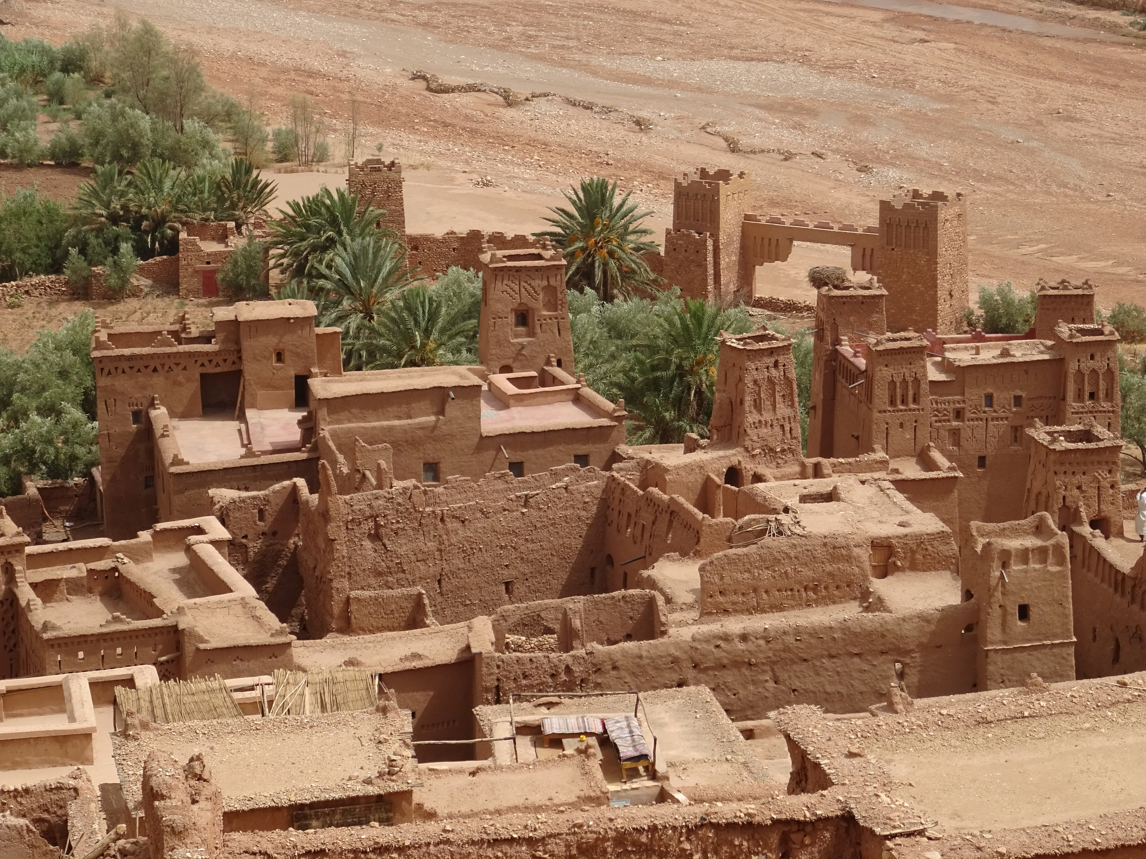
Ait Benhaddou or ksar (fortified village) sits on the old caravan route from the Sahara to Marrakech. It dates back to the 11th century and is a UNESCO World Heritage Site.
One thing worth remembering about the construction of buildings such as those at Ait Benhaddou is that they are constructed of earthen clay. They will not last indefinitely and so many appear in a semi-demolished state. Heavy rainfall being one culprit.
Ait Benhaddou is sited in the strategic Ounila Valley which was one of the main routes over the High Atlas via the Tizi n'Tichka pass. There are some wonderful stories about the tribes and chieftains who lived in these valleys who demanded payment for the caravans to pass. The Glaouri dynasty who had a kasbah at Telouet feature heavily in the area's history.
Next time you watch the film Gladiator look closely, it was filmed in part at Ait Benhaddou.
El Borj Camp
Telouet Camp
Ounila valley
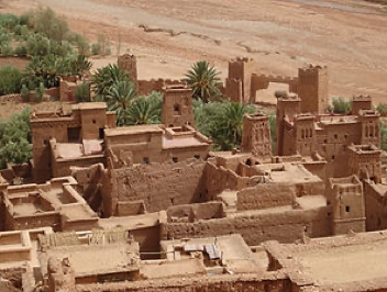
Ait Benhaddou
Ait Benhaddou
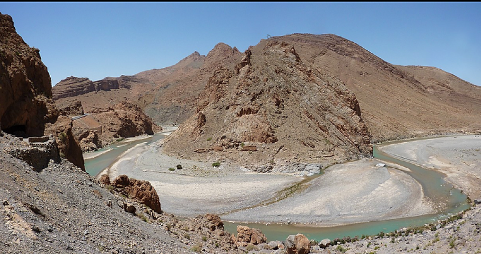
Oued Ziz
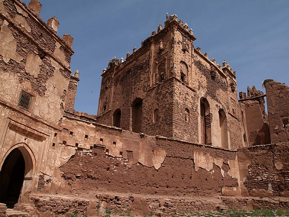
Kasbah Glaouri
Inside kasbah Glaouri
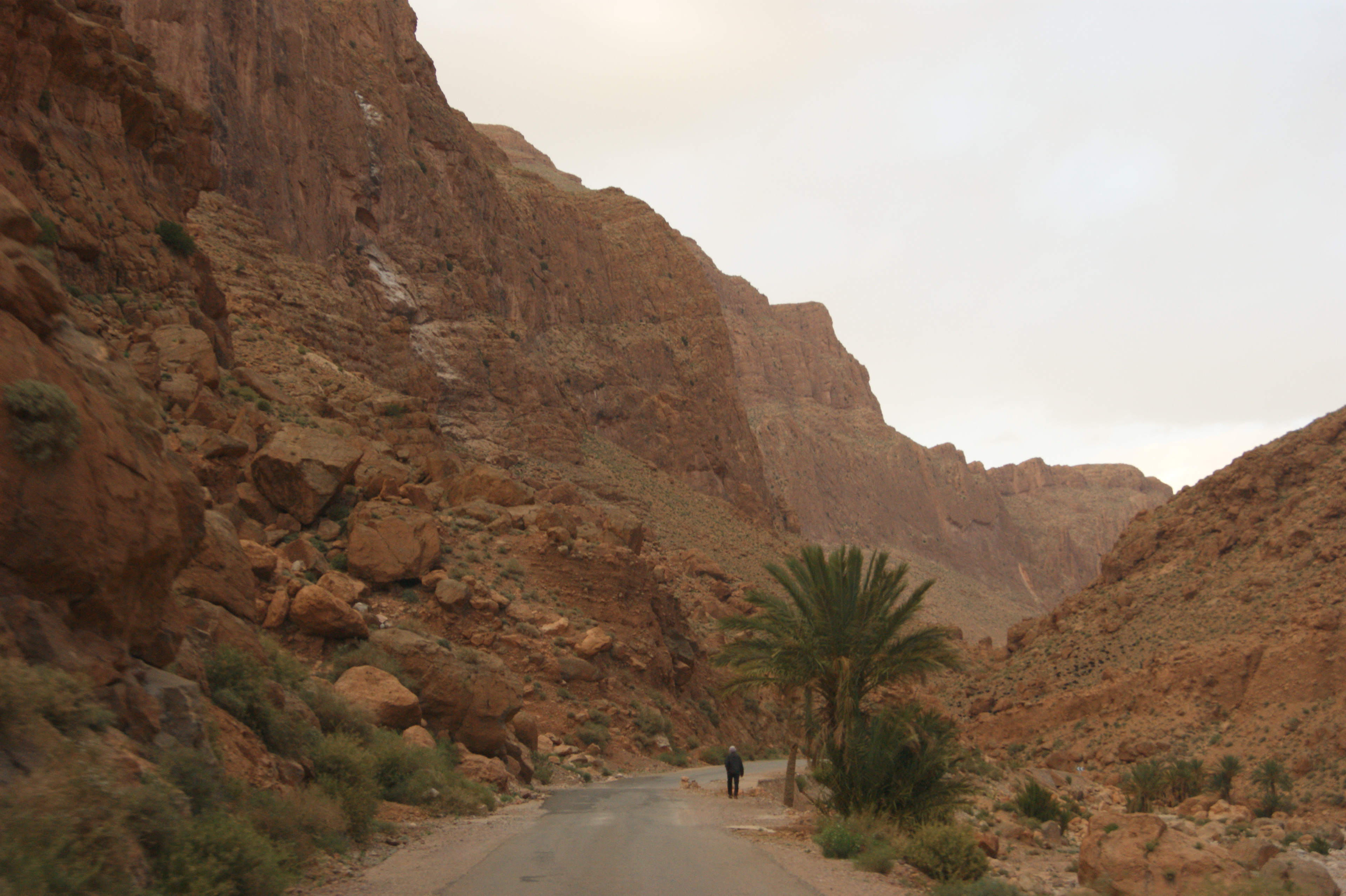
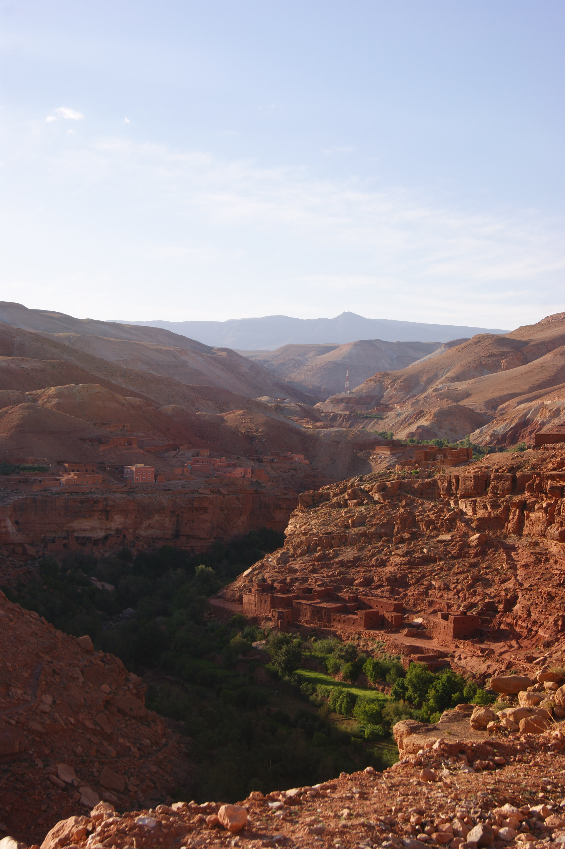
From Ait Benhaddou the expedition travelled to Telouet and camped overnight near the village, on the southern flanks of the High Atlas. A journey up the Ounila Valley gives amazing views down into the narrow isolated valley, dry and desert like on top with green date palm, fruit trees and cereals growing deep down in the valley base.
In 2014 the expedition camped at Telouet near the kasbah Glaouri. Unfortunately, my man in the village had not told the local police nor the qaid that we were arriving and they were somewhat perturbed as we set camp. The police chief came and insisted I went with him to see the top man, I think the expedition thought I had been taken away by the secret police, never to return. Through my Berber interpreter I managed to offer huge apologies for the confusion, highlighted that we had brought clothing for the village children and would be gone in the morning, not leaving any trace. Thankfully he accepted my 'amende honourable' and let me go.
In 2016 clouds began to form as we climbed higher towards Telouet and then rain fell. The roads began to wash out and it was becoming a deluge, and dangerous. We stopped and I briefed the team; we were getting off the mountain slopes and heading back to Marrakech. A telephone call secured accommodation at short notice.
We arrived back into Marrakech about 11pm. It was dark and of course everyone and every vehicle was on the streets. Trying to keep three minibuses and two 4x4's in convoy was 'mission impossible'.
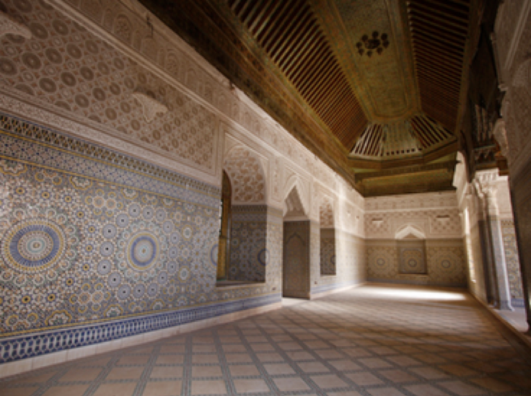
We managed to make it to Bab Ksour, bab being a gate, at the wall entrance to the medina. We had some porters with hand carts to take all of the baggage to the hostel. The alleyways are so narrow in places that the way to the hostel was from Ksour, it was too narrow to approach from Djmaa el Fna, the main square.
Two days in Marrakech allowed for bartering in the souk and sightseeing in the city.
On the final evening, after present giving to the leader team and most young people in some form of Moroccan dress, a dinner would be held at a restaurant. The restaurant overlooks Djmaa el Fna square and so everyone could have dinner and watch the square fill with stalls and people as the sun set. Story tellers, men with Barbary macaques, women applying henna, snake charmers and a whole plethora of other stalls brought the square to life.
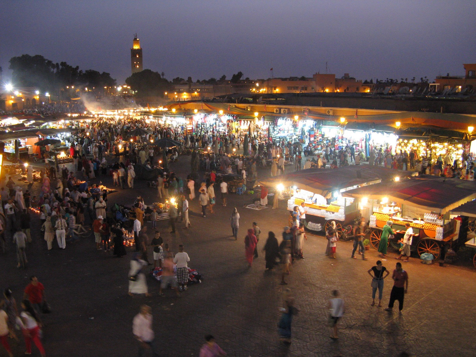
Djmaa el Fna
It does take a little while to settle back into a home routine after completing an expedition but it's not long before one begins to consider, where next?