I had unfinished business in the southern Alps.
During June and July last year (2022) I walked the GR5 / GR55 from Lac Leman to Nice. I had intended to finish on the variant route, the GR52 at Menton, but circumstances dictated I continued to Nice.
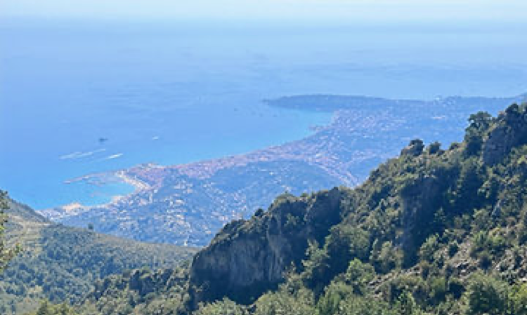
The GR52 has a more dramatic finish high above Menton giving impressive views of the town and the Cote d’Azur from the Col du Berceau (1090m). It is also more mountainous.
On the afternoon of Tuesday 5th September, I caught the TER train from Saint Raphael – Valescure to Nice – Saint Augustin. The latter is a newly built station adjacent to Nice Airport alongside recently constructed high rise offices and hotels, very concrete.
My plan was to take the number 90 bus from Grande Arenas to Saint-Dalmas (Valdeblore), which is where the GR5 and GR52 meet. In the village the GR5 heads south whilst the GR52 turns briefly north before heading south closer to the Franco / Italian border.
I managed to find the bus request not far from the rail station. I had about an hour to wait until the departure time of 4.30pm. I was joined by four French guys all dressed similar to me and of comparable age, also with large rucksacks, who I assumed were heading into the mountains. It looked like a pensioner’s day out.
The number 90 bus arrived at 4.15pm and at that moment a woman who had been waiting at the request informed the French chaps, and me, that we needed a pre-paid card to use the bus service, cash was not accepted. There was then a mad dash to a ticket machine near the rail station for me and my fellow trekkers. It seemed to take an age for the four of them to purchase their tickets and I was beginning to panic that I would miss the bus. One of the guys indicated I should put my credit card to the machine as they had sorted the pre-paid card for me. I did check that I was not paying for everyone!
A hurry back to the bus and we all boarded for the journey into the southern Alps.
The route north from Nice initially followed the Var River, passing through the suburbs of the city. The bus was really a coach, new, comfortable, air-conditioned and … large.
As we left the outskirts of Nice the road became narrower, and narrower. The bus route provided a service to villages in the Var and Vesubie valleys and at some of them it seemed impossible that the coach would be able to access the village at all.
The road continued to climb passing through tunnels and traversing hairpin bends with the driver sounding the vehicle’s horn to warn oncoming traffic. When one was met there were only inches to spare as we squeezed between it and the road edge.
Near Levens we turned away from the Var into the Vallee de la Vesubie. It was in the high, steep sided valleys such as Vesubie and Tinee that saw the catastrophic floods during 2020 caused by Storm Alex. I saw the devastation on French television but to see it for real, and the ongoing reconstruction, brought into sharp focus the extent of the disaster. Whole houses and communities were swept away as the torrents of water rushed down the valleys with eighteen people killed, eight never found. The village of Roquebilliere Vieux highlighted the extreme forces of nature with large swathes of land having just disappeared down river.
We passed through Saint-Martin-Vesubie where a large heli-pad had been constructed to allow help to be airlifted into the valleys. Ninety-one houses were destroyed in this village alone.
When we, safely, arrived at Saint-Dalmas I made a point of thanking the driver for their skilful manoeuvring, it was impressive how they patiently negotiated the narrow valley roads and villages.
Camping a la Ferme at Saint-Dalmas is where I camped whilst on the GR5 and it was to here that I returned. It is owned by Myriam and Bernard Le Duff who have a small farm selling vegetables, honey and eggs, with a camping area. When I arrived M. Le Duff was, as before, sat outside his house reading and waiting for trekkers to arrive, usually shattered after a long day on the GR5. Tall with swept back grey hair and a neatly trimmed moustache he was always welcoming, relaxed and friendly. The campsite reflected this too.
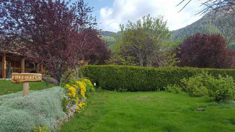
Camping a la Ferme
In the town there is a convenience store so I was able to buy supplies of Beaufort cheese, saucisson and bread, my essential food for the mountains.
Beaufort is a raw cow’s milk alpine cheese from Savoie; aficionados will tell you that the summer variety (Beaufort d’ete) tastes different as the cows (les vaches) have been in high pasture (l’alpage), giving it a pungent aroma reminiscent of alpine pasture! When I opened my rucksack after a few days trekking I was never sure whether it was my socks or Beaufort that greeted my nostrils.
Wednesday 6th September; walking day one. Saint-Dalmas is at 1290m, within the Val de Blore. Walking into the village from the campsite, just before the ancient Eglise Sainte Croix a Saint Dalmas, I turned left onto the GR52 and began the climb to Col du Barn (2452m), 1162m of ascent from the get-go!
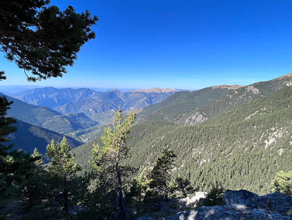
The sides of the Vallon de la Chanaria were forested opening out onto clear felled-slopes as I negotiated Plan de la Gourra and Col de Veillos. It was a strenuous climb to start the trek but at Col du Barn I entered the Parc National du Mercantour with fine views of the mountains ahead.
From the Col du Barn it was a convoluted, steep and stony descent on a boulder slope before entering forest. After about 1hr 30mins the Vacherie du Collett (1842m) came into view on the left. I could hear the clanging of bells on the vache as I neared the vacherie which reinforced the alpine feel. The path continued straight-ahead, over a track, with a large wooden cross adjacent to the path.
I had another climb to Col de Salese (2031m) before descending again towards Le Boreon (1474m) the end of this day’s walking.
The descent was through forest on a gritty, rocky path that became a small valley which had been badly affected by flood water. Trees had been uprooted and piled high when they had come against an immovable rock and parts of the valley side had washed away. Subsequently the path had been re-routed and it took concentration to remain on-track but eventually I emerged onto a road, earlier than expected, and continued to descend to Le Boreon on tarmacadam.
A track ran off left, which I took, and this went by a gite d’etape. I noticed there was a tent on a small grassy balcony nearby and so I enquired at the gite if I could camp, which I could. €6 was the camping fee but gave access to the shower and toilet facilities in the gite.
The guardian asked if I would like to have evening meal at 7pm, so why not? It would be better than freeze dried rice and chicken!
For some reason Europeans seem to find the name Ian difficult to relate to, so to make things easier [for me] I answer to Yann.
There were a number of trekkers having dinner; after the starter the guardian came to my table (of six people) and said, “Yann, this is for you.” I was handed a dish of potatoes with cheese and two spicy sausages. Everyone else had a large lasagne to share per table. I still do not know how I qualified for special treatment but it was gratefully accepted!
I had pitched my tent on the small balcony alongside a couple from the Netherlands. My tent is a 1.5 person one, so quite small and it only just fit on the balcony. But, well fed and showered I slept well, cautious not to move too much in the tent and drop off the edge of the balcony to the track below.
Thursday 7th September: after a breakfast of Beaufort, saucisson and bread all of which, except the cheese, had been infested by ants I sorted my kit and prepared to depart. According to my route detail I was to continue along the track by the gite. Thankfully one of the guys I had dined with had spoken with the guardian and found out that the GR52 route had been barriered because of landslides.

Le Boreon
So, a twenty-minute walk on a road alongside Le Boreon Torrent before heading uphill into forest. I knew that if I kept the torrent to my left I was heading generally in the right direction. I walked on a forest track before seeing a marker for the GR52 which took me onto a small path emerging on a higher track.
The four French guys who had helped me obtain a bus card had stayed at the gite overnight and started walking before me. They had obviously taken a different, longer route so imagine their surprise when I popped out on the higher track, almost bumping into them. I continued the ascent to Refuge de Cougourde with them, where they rested.
From the refuge I climbed to a lovely lake, Lac de Trecolpas (2150m).
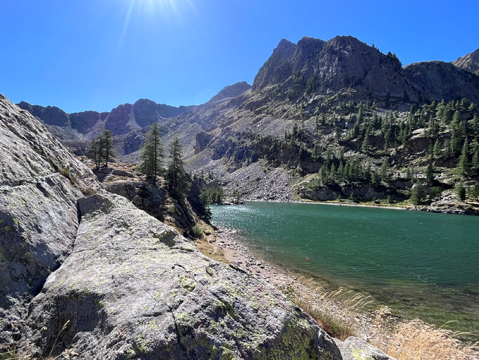
Lac de Trecolpas
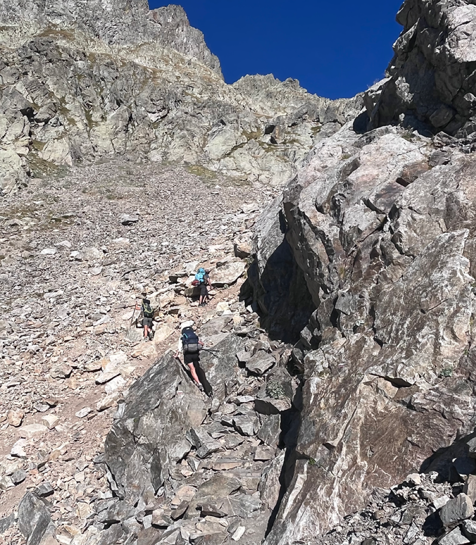
From the lake it was a steep, zig-zag path up a boulder slope to a high col, Pas des Ladres (2448m). It was hard work and by the time I had reached the col I was shattered, sweat was dripping off my elbows as I used my trekking poles to help heave me and my weighty rucksack up the mountain.
Ascending towards some of the cols, particularly Ladres and Colomb (later) you entered what I would describe as a cirque or combe with no visible exit. The footpath simply disappeared into a boulder field and what you might perceive as the route bears no resemblance to it at all. It does test one’s mental resilience on occasions. In rough terrain gains and losses in altitude mean more than horizontal distance.
As on the GR5 I had tried to keep kit to a minimum but I still had a tent, stove, food and clothing to carry. As supplies were not readily available I had a few days’ worth with me. I suspected water would be difficult to source too so carried 2-3 litres, which meant 2-3 kilos in weight.
At Pas des Ladres I had considered turning left and climbing to Col de Fenestre (2474m), which is the border between France and Italy, but after the challenging climb to Ladres I opted to continue to La Madone de Fenestre (1903m) instead, downhill!
La Madone de Fenestre has a pilgrim chapel, CAF refuge and buvette. It owes its name to a hole in the Cayre de la Madone, a rock behind the sanctuary where the Virgin appeared one day. It has a statue in Lebanese Cedar dedicated to La Vierge which dates back to the 14th century.
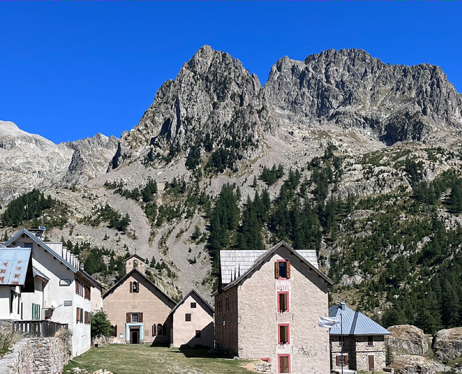
La Madone de la Fenestre
I rested at the buvette and had an obligatory piece of myrtle pie.
When I arrived at the Pas des Ladres there were three young people sat resting after the climb, a young man and two young women, probably mid-twenties. I subsequently spent some walking time with them; Albert, Marie and Emma. The girls had just qualified as General Practitioners and Albert was in his 5th year, they were from the north of France. It was Emma who asked where I was going and where was I from.
I joined the young team, who had trekked some of the GR5, and headed for the sanctuaire.
After refreshments at the CAF buvette I set off, leaving the team to their pie and phone charging.
Downhill briefly to the Vacherie de la Madone and then the climb started, and boy was it a climb! Initially towards the Cayre de la Madone passing sparse pines and then the steep boulder slope began. At one point it was three points of contact as I squeezed through gaps and over large boulders remembering to keep my weight forward otherwise the weight of my rucksack would have pulled me backwards, sending me crashing down the steep slope.
Remarkably there were some small patches of snow in gulley’s near to the Cayre. A red and yellow coloured helicopter, Sapeurs-Pompiers, was hovering around the ridge and appeared to be on a rescue mission.
I stopped for some respite and was caught by the team who I then joined on our bid to the col.
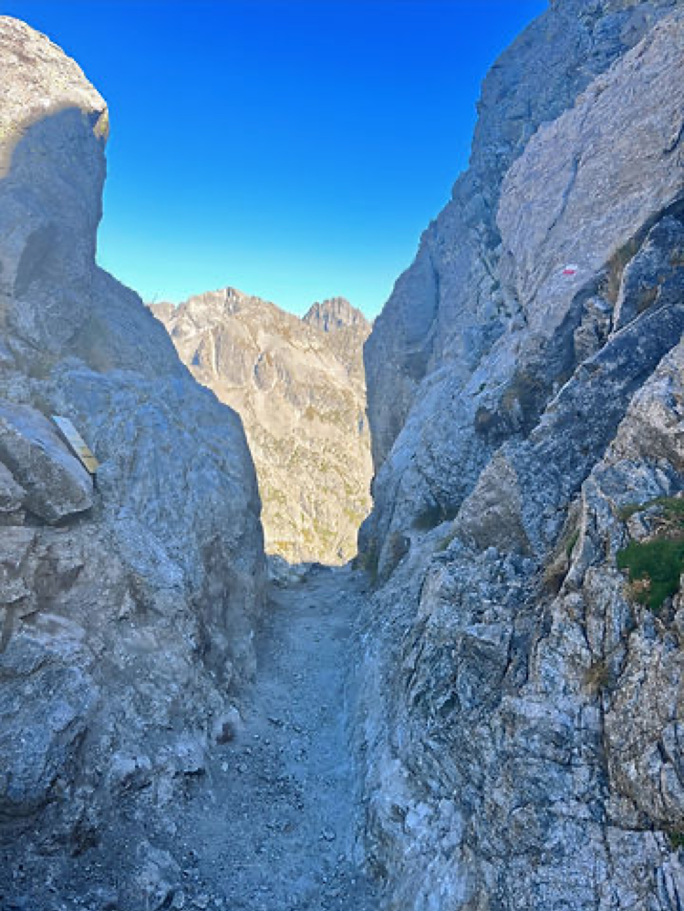
The path climbed one last rocky section to arrive at a narrow col, Pas du Mont Colomb (2548m). The rock here was very crumbly and this weakness formed the col. If you had a wide girth or rucksack you might struggle to pass through.
We all continued through the gap at the col and immediately began the descent to La Barme (2150m). It was a ‘technical’ ascent at first, directly from the col, very steep and rocky. Some trekkers might have felt the need for a confidence rope.
It had been a long day thus far, it had taken almost two hours to summit Pas du Mont Colomb and by the day’s end ten hours of walking.
We arrived at Lac de la Fous, a reservoir, with Refuge de Nice (2232m) sitting prominently overlooking the lake. Cloud had arrived and the temperature had dropped. Even though we were effectively in a bowl a strong wind began to blow. I pitched my tent back-end to the wind direction near to the lake and hoped for the best, the gusts increasing in strength. It was freeze dried chicken and rice for dinner and it was necessary to shelter the stove from the wind to boil water for the meal. I had enough hot water to make a cup of coffee, Taylor’s of Harrogate Hot Lava Java No.6, one has to spoil one’s self occasionally, which I savoured as I waited the ten minutes for the food to reconstitute itself.
I did not sleep well that night. I’m not sure if the wind blowing from the direction of Baisse du Basto created a venturi effect but on a few occasions, I thought the tent would leave me and end up back at the Sanctuaire de la Madone Fenestre.
Friday 8th September; I awoke to find I was still, thank goodness, inside my tent and all was in order. I have had the Terra Nova for about twenty years and it has withstood some harsh winter weather in its life, although now starting to show its age (like me).
I had a slightly later start to the day as the route to Refuge des Merveilles was only a five hour stretch. I left the team to their breakfast.
The GR52 wound its way from our bivouac site up past the refuge, into a boulder field, steep at first, levelling and then steep, rough and rocky to Lac Nire (2353m).
From the lake I passed a couple of smaller lakes and then began the climb to Baisse du Basto (2693m). I have to confess I did rename the col ‘Baisse du Bast**d‘ as again it was challenging, scrambling over boulders and rocks. The descent led to Lac du Basto where I sat overlooking the shimmering alpine waters on a small crag. Not another person in sight; complete silence, … and relax!
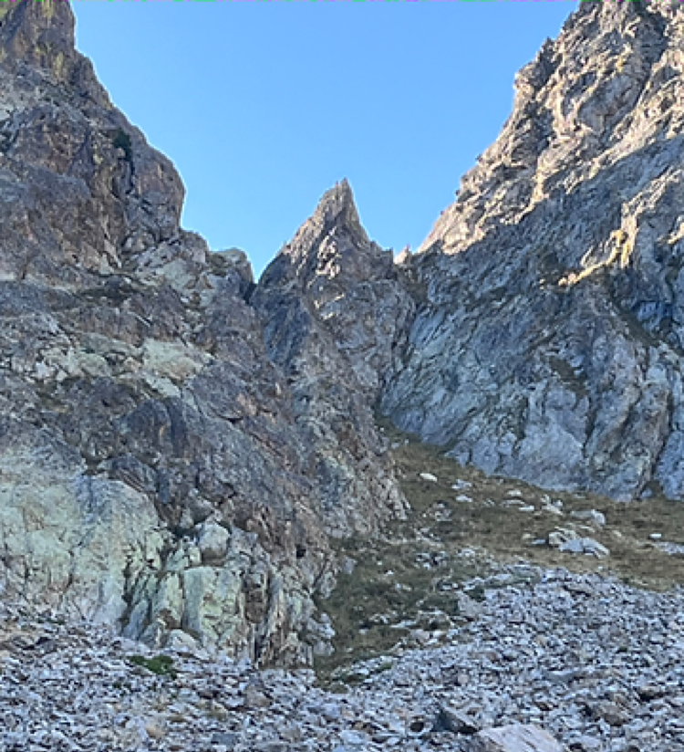
All good things must end and so I dragged my butt from the crag and started uphill again to the Baisse de Valmasque (2549m). From the col there was a wonderful view down the rugged Vallee des Merveilles.
Vallee des Merveilles
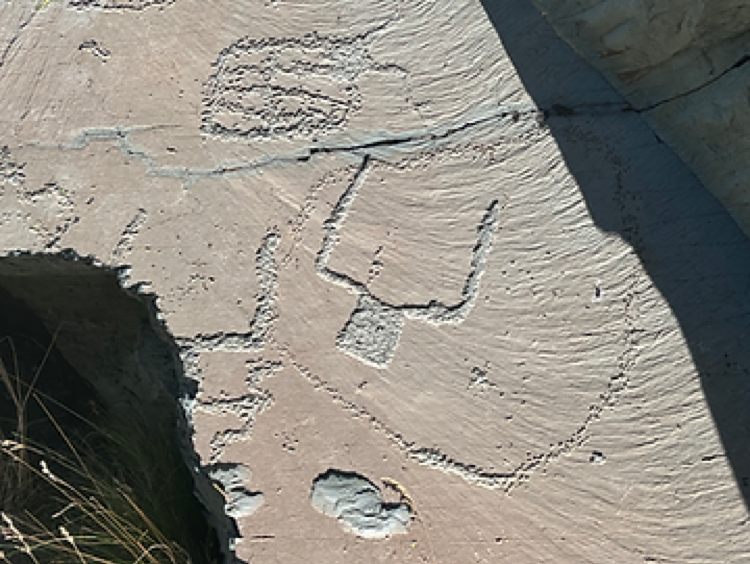
Bronze Age Rock Art

Bronze Age Rock Art
As a protected site, walkers must not use trekking poles, must stay on the main path except where signposts allow visits to specific sites.
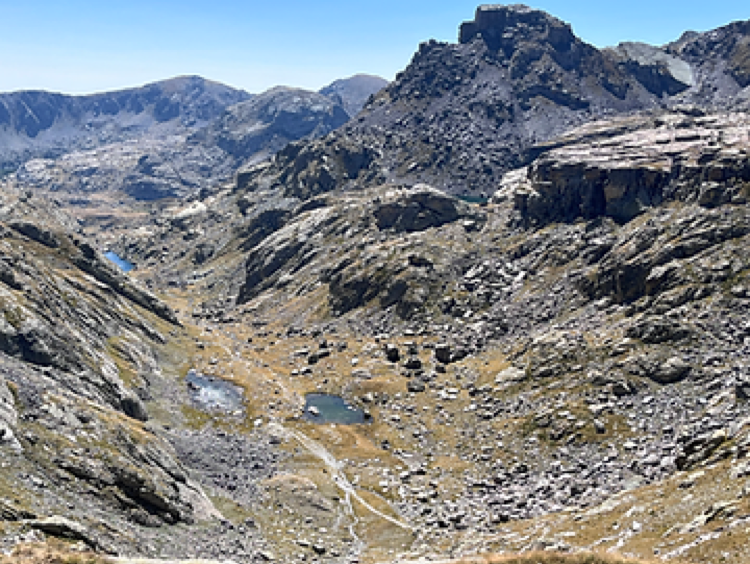
To enter the valley from the previous boulder strewn cols and see the smooth, polished, glacial rock was a huge contrast. The smooth rock formed the perfect canvas for the Bronze Age art.
I walked through the valley passing Lac des Merveilles and little Lac Mouton to arrive at Lac Long Superior and Refuge des Merveilles (2130m). Volcanic breccia and conglomerate boulders littered the valley, some in quite unexpected positions.

It was 3pm when I arrived at the refuge and I was so looking forward to a three-egg omelette with fromage & lardons, but it was not to be; I had missed hot food time. So, it was a salad and 1ltr of sparkling bottled water.
The bivouac rule is that you cannot pitch your tent before 7pm. There was an aire du bivouac near the refuge, which is free to use, and because I had elected to have dinner at the refuge I was given thirty minutes grace to pitch at 6.30pm. I claimed my flat pitch next to an alpine stream that had a small pool, not quite big enough for a swim but certainly a good wash, including my shorts and shirt.
As I was sat at the refuge the young team arrived and rested. They said they would walk for a couple of hours more and then bivouac.
I took the opportunity to lay out for an hour in the warm afternoon sunshine, looking at Mont Bego to my right, holding pride of place above the valley; there was not a cloud in the azure blue sky.
Topophilia; is a strong sense of place. Yi-Fu Tuan employed the term for the feeling-link between person and place as part of his development of a humanistic geography. I certainly felt a ‘love of place’.
At 6.30pm I pitched my tent and as I was doing so the team walked past. They had decided to bivouac near the refuge as well.
Dinner at 7pm was vegetable soup, rice, sausage in sauce, cheese and cake. It filled a very empty stomach.
I was sat at a table with, amongst others, two young chaps, French, who looked very agile and able to speed up mountains and next to me a French guy from Antibes. He was a satellite specialist working for Airbus Defence and Space, studied at Birmingham UK whose English was much better than my French. It was an interesting evening’s conversation. He was very impressed by the fact that I carried Beaufort and saucisson as my staple diet.
I retired from the refuge to my tent and was serenaded to sleep by the sound of the alpine stream nearby. It was a clear sky and with no ambient light every star and planet shone brightly with the mountain summits contrasting against the glow.
Saturday 9th September; I’ll just take a moment to explain my tentative schedule. I had planned, today, to summit Mont Bego but decided this might not be the wisest of choices given I still had to get to Menton, which presented me with a bit of a quandary. I had a conference call scheduled for 7pm BST on the 11th September for which I would need either Wi-Fi or cell. I had planned to be in Sospel on the 11th but that had now changed. So, I decided to commit to two stages in one day and go direct to Sospel, missing out Camp Argent and thus arriving in Menton on the 10th with a train home. Sorted.
It had to be an early start so up at 6am tent struck and kit packed. I set off over a small hill and came across the team. Marie had hot water on the stove and shouted, “Yann! Coffee?”. How could I refuse. They were a wonderful trio of young people. As medical practitioners perhaps, they felt that their Hippocratic Oath meant looking after the older walker. I enjoyed their company and exuberance.
After coffee we set off together to Sospel.
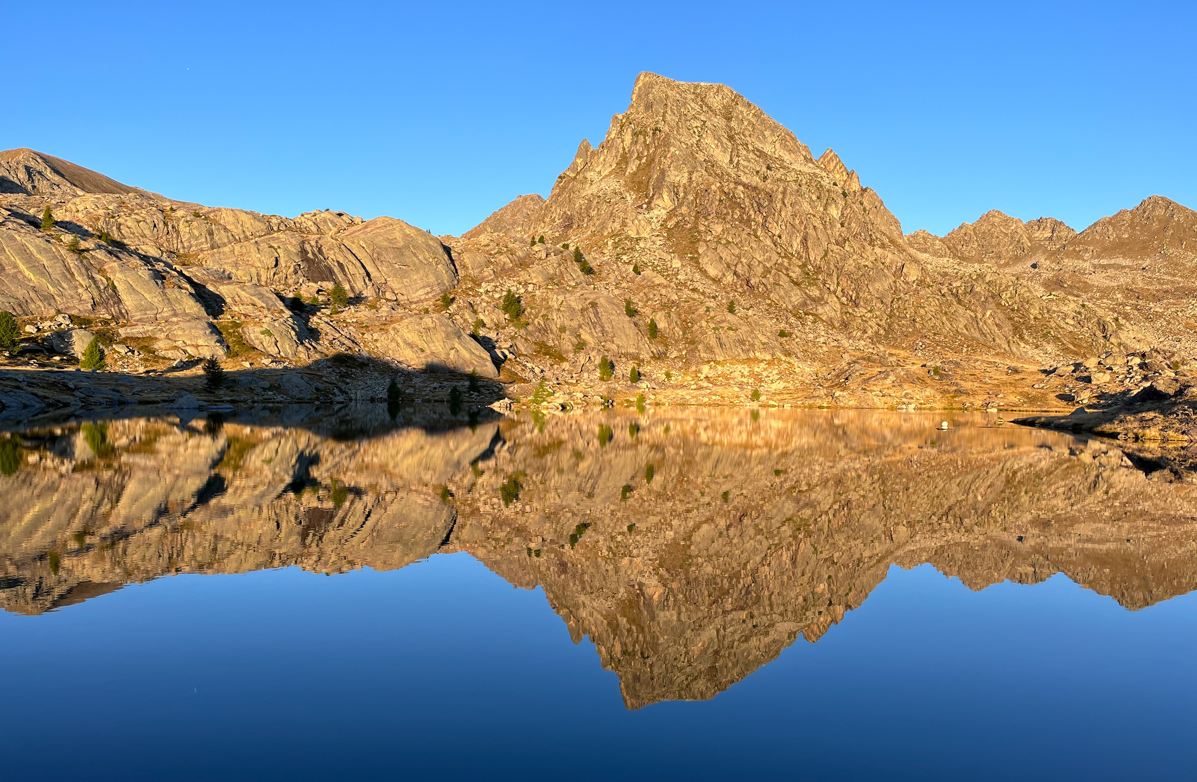
Past Lac Fourca and through a natural breach in the rock to Lac de la Muta with the adjacent peaks mirrored in the still waters.
An easier climb led to Pas du Diable (2430m) which was something of a non-entity, here we exited the Parc National du Mercantour. From the col we descended, climbed slightly, contoured around slopes of grass and boulders across the col of Baisse Cavaline (2107m), the slopes of Cime de Raus to the Col de Raus (1999m).
We could see L’ Authion (2080m) in the far distance and a steep track leading to it. Downhill slightly, first to Baisse de St Veran (1836m) and then a zig-zag path to the summit. Here were the ruins of barracks and the Redoute de la Pointe des Trois Communes, which was an important site for the defence of the Alpes-Maritimes.
We stopped for lunch at some concrete bunkers near Cime de la Gonella. The younger team members cooked packet mashed potato whilst I had the last of my Beaufort and saucisson. I took a little less time (French lunch is a sacred thing) and so left Albert, Emma and Marie knowing they would catch me before Sospel.
It was generally, but not always, downhill to Sospel. I passed an old cannon barrel, which must have been 10ft in length, at the side of the path; I have no idea how it came to be in such a nondescript location. Past Baisse de la Liniere (1342m) and Baisse de Figuiera (750m) that brought me to Sospel (350m).
I met a young chap who was walking uphill from Sospel. He was from the Basque country and the Pyrenees were his home turf. He had decided to walk the GR52 south-north and was looking for a bivouac spot for the night. We stopped and chatted for a while about the route and then continued in our opposing directions.
I arrived in Sospel about 6.30pm and had expected the team to catch me before the town but they were nowhere to be seen. I rested at the town’s fountain and telephoned my wife to let her know of my safe arrival. I had lost track of days and was reminded it was Saturday; that prompted me to quickly go to the local store and buy supplies for the following day as I suspected most shops would be closed in the town on Sunday, and there was nothing between Sospel and Menton which was over 7hrs away.
Sospel has been settled since Neolithic times and was a stage on the Route du Sel, or Salt Route, from Nice to Piemont. There is still the toll bridge, Vieux Pont. The Cathedral of St Michael dates from 1762 and is one of the grandest in the Alpes-Maritimes. Mont Agaisen stands guard over the town with military structures dating from the 1930’s associated with the border disputes with Italy.
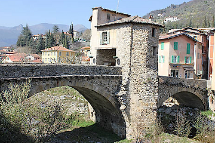
Sospel
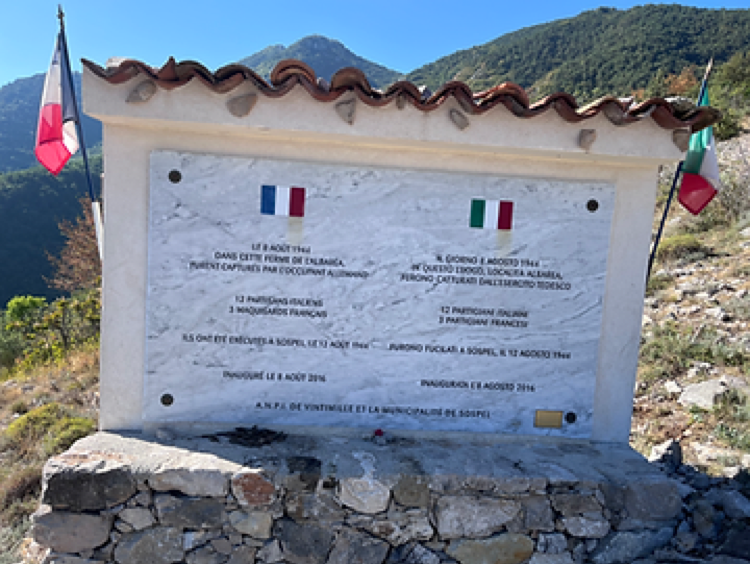
WW2 Memorial above Sospel
I had heard that the campsite at Sospel had closed (and it had) so I needed to find somewhere to sleep. It had been a long day so I negotiated a ‘walk-in’ price at a hotel, which included breakfast. It did mean I could have a shower and wash my clothes. My Hoka trail shoes stayed on the window ledge outside!
I ate pizza and salad at a local café. I was very hungry and whilst the pizza was delicious I could not eat it all. It was great value for money and La Cabraia, near the fountain, comes highly recommended.
One further benefit of being in the town was that I could, with a clear conscience, deposit the waste I had been carrying for several days into a bin.
Sunday 10th September; just 20km and 1170m of ascent remaining to arrive at Menton.
The temperature gauge in Sospel showed 25C at 8.30am. Over the previous days, other than near Refuge du Nice, there had not been a cloud in the sky, just a clear, bright blue ceiling, with temperatures in the high 20’sC.
I had noticed red/white markers near the fountain and wondered if they took the GR52 round the back of the town and onto the ascent to L’ Albarea. It turned out they didn’t. I wandered back to the main road alongside the river and saw three young people enter a boulangerie, who I immediately recognised.
It transpired that Emma, Marie and Albert had arrived in Sospel the previous evening, found no place to bivouac and had pitched their tents in the camping-car parking area. Albert said they could not use tent pegs because of the hard surface! They had eaten pizza in a restaurant opposite to me.
The boulangerie had a small café and they were eating a huge plate of bread, cakes and pain au chocolate. I joined them and had coffee.
Once they had eaten their body weight in pastries we set off south.
I had heard the sound of voices shouting, dogs barking and gun shot in the adjacent hills and guessed that hunters were out and about. It was also the village fete and preparations were ongoing for the day’s festivities.
We left Sospel and started uphill through mixed forest, initially on a track and then a forest path. I saw some men approaching on the path towards us wearing bright orange tops. They had large dogs with them and were, obviously, the hunting party. It was not until they closed that I saw the large wild boar that had been shot. It was being dragged by two of the dogs which were tethered to it by rope. We stepped to one side to let the party pass as the boar bounced over the tree roots down the path. It was going to be a heck of a BBQ at the Sospel fete.
I often chuckled as the three, Albert, Marie and Emma, walked; they never seemed to stop talking. Walking up the path Marie said, “We’re only talking to let the hunters know we are here”. That made me laugh more!
We arrived at L’ Albarea (2093m) and found a water trough full of water. It was an opportunity to refill bottles (I have a Katadyn filter) before heading on. Nearby was a joint memorial, French and Italian, to twelve Italian partisans and three French maquisards who had been captured by German forces, taken to Sospel and executed on 12 August 1944.
We continued to climb through forest to Col du Razet (1032m), which gave views to the Mediterranean. I had hoped it would be mainly down-hill to Menton but the GR52 had not finished with us yet.
Colla Bassa (1107m) was ascended and then it was a downhill stretch to some level terracing where I stopped in the shade of a tree for some lunch. The team continued ahead.
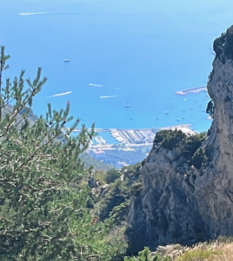
From Colla Bassa I walked under a pylon line (800m) and climbed to Col du Berceau (1090m). From here, on a higher crag, the harbours of Garavan and Menton can be seen. Albert, Emma and Marie had climbed the crag ahead of me and so I continued to follow the path and start the descent to Menton-Garavan with Marie waving and shouting, “See you in Menton” from the crag.

The path was treacherous, it was very steep and covered with marbles, well small rocks and gravel, which had me on my bottom a couple of times. It was slow work and it seemed to be getting hotter. Past Monieri (280m) and I found myself getting more and more frustrated with the inability to make reasonable progress.
Eventually I arrived at houses on the outskirts of the town. A long, part concrete path, with steps took me towards the sea and I eventually emerged on the promenade. Happy to just be at 0m I made my way to Gare Menton-Garavan.
I had checked the SNCF train app. and knew there were trains to either Cannes or Nice between 4pm and 5pm, it was 4pm.
The station was an old building and a platform, no services or vending machines. I was thirsty and tired, and had been looking forward to a Coke, but it was not to be.
I walked onto the platform and sat down on the first bench I found, untangled myself from my rucksack which was then behind me against the wall and tried to recover from the descent.
There were a number of Police Nationale officers on the platform and one walked up to me and said, “Get up.” I thought, how bloody rude and replied, sharply, “Why?” The French Police always operate in ‘gangs’ and do look quite intimidating with all of their kit but I was tired, irascible and not willing to be spoken to in such a manner. His next words did the trick though, “Scabies”.
It transpired that migrants from Italy were brought off the train here and many were infected. I was sat on ‘their’ bench. I chatted with the officer and he said, now knowing my history, “Go sit with my colleagues at the other end”.
It was now 4.15pm and a train to Cannes was due at 4.23pm. The only way to get a ticket, you cannot buy one on the train, is a machine on the platform. The Police Officer said, “Don’t worry, we control the train”. I couldn’t get a ticket in time so hopped onto the train without, on the advice of the Police Officer, which was a mistake!
We had no sooner left the station than three ‘ticket police’ appeared. I endeavoured to explain, blaming the machine and police, and I think they took sympathy on me. I was not looking my best with salt/sweat stained top and shorts but I managed to sweet talk my way out and they let me buy a ticket to Cannes. There was an Australian girl sat opposite who couldn’t pay and she received a €400 fine!
Menton, nicknamed the Pearl of France, has always been a frontier town. It was a possession of the Grimaldis of Monaco until the 1860s. It is also the site of the ‘Grimaldi Man’, a name given to two skeletons dating to 26,000-22,000 years ago.
Popular with British and Russian aristocrats (no surprise there), who built many of the hotels, villas and palaces which grace the town today. The Cimitiere du Vieux Chateau has the graves of princes, peasants, exiles and some from countries that no longer exist.
Menton has its own dialect ‘Mentonasc’.
Using the live SNCF app. I hopped off the train at Nice-Ville and onto the TGV (with a ticket this time) heading to Paris, which stopped at Saint Raphael. Fortunately for me my seat was on the top deck next to the restaurant car. As soon as the train wheels began to turn I was at the counter buying refreshments.
It had been a delightful few days, although slightly shorter than planned trekking the GR52 and was certainly a better approach to the Mediterranean than via Nice. Once again, I met some friendly, welcoming people who enhanced the journey. Sadly, I did not have the opportunity to see Emma, Marie or Albert in Menton, swim in the Med to celebrate and say ‘farewell’, but I wish them every success in their chosen careers as medical professionals.
Caveat: apologies but accents are absent; acute, grave and circumflex etc. I blame the software!